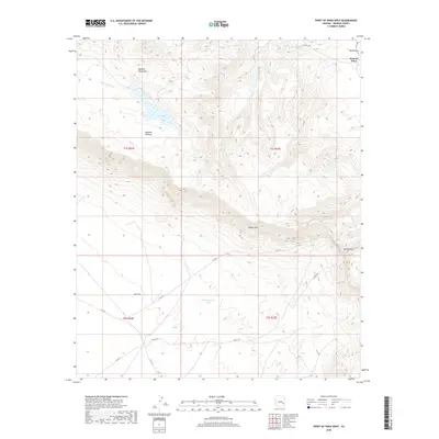
2018 Map of Point of Pines West
USGS Topo · Published 2018About this map
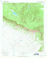
The settlement at Point of Pines anchors this high-elevation landscape in Graham County, marking a critical point of human activity between the Natanes Mountains and the sweeping Ash Flat to the south. This 2018 survey illustrates a complex terrain where the Natanes Plateau drops sharply at the Nantac Rim, a dramatic geological feature that dictates local movement and water drainage. Small seasonal water sources like Dry Lake and infrastructure such as Headquarters Tank suggest the area's continued use for ranching and resource management. The map details a network of backcountry routes, including the Antes Trl and various county roads that thread through Barlow Pass and across the Big Prairie. These pathways connect the disparate drainages of Clover Cr and Point of Pines Cr, revealing how contemporary land use still follows the natural contours of the high desert topography.
Find a feature on this map
21 named features on this map. Tap any name to fly to it.
Don’t see what you’re looking for? This feature index may not catch every label — zoom into the map to look around manually.
Map Details
Editions of this 2018 Point of Pines West Map
This is the sole edition of this map. No revisions or reprints were ever made.
Other maps of this area

1954 · Clifton
USGS Topo · 1:250,000

1957 · Clifton
USGS Topo · 1:250,000

1958 · Clifton
USGS Topo · 1:250,000

1960 · Fort Thomas
USGS Topo · 1:62,500

1962 · Clifton
USGS Topo · 1:250,000

1962 · Bryce Mountain
USGS Topo · 1:62,500
1967 · Sawbuck Mtn.
USGS Topo · 1:24,000
1967 · Point of Pines East
USGS Topo · 1:24,000
1967 · Natanes Mts NW
USGS Topo · 1:24,000
1967 · Point of Pines West
USGS Topo · 1:24,000