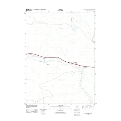
2012 Map of Point of Rocks
USGS Topo · Published 2012About this map
Point of Rocks serves as the primary settlement hub in this part of Sweetwater County, situated along the vital transportation corridor defined by Interstate 80 and the historic Overland Trl. The landscape is dominated by the meandering path of Bitter Cr, which cuts through the high desert terrain alongside features like Coon Draw and Shiprock. To the north, the Jim Bridger Reservoir provides a significant water source in an otherwise arid environment, accessed by 9 Mile Rd. The map illustrates the juxtaposition of modern infrastructure and traditional routes, tracing how the I80 Service Rd follows the same general path as the older pioneer trails. Notable drainage patterns such as Deadman Wash and local thoroughfares like Black Buttes Rd provide detail for those studying the regional geography and historical transit lines in southern Wyoming.
Find a feature on this map
10 named features on this map. Tap any name to fly to it.
Don’t see what you’re looking for? This feature index may not catch every label — zoom into the map to look around manually.
Map Details
Editions of this 2012 Point of Rocks Map
This is the sole edition of this map. No revisions or reprints were ever made.
Other maps of this area

1954 · Rock Springs
USGS Topo · 1:250,000

1958 · Rock Springs
USGS Topo · 1:250,000

1958 · Twelvemile Well
USGS Topo · 1:62,500

1958 · Superior
USGS Topo · 1:62,500

1962 · Rock Springs
USGS Topo · 1:250,000

1968 · Bitter Creek NW
USGS Topo · 1:24,000

1968 · Point Of Rocks SW
USGS Topo · 1:24,000

1968 · Black Buttes
USGS Topo · 1:24,000

1968 · Point Of Rocks
USGS Topo · 1:24,000
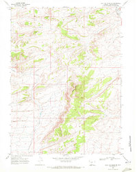
1968 · Point Of Rocks SE
USGS Topo · 1:24,000