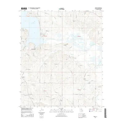
2015 Map of Point
USGS Topo · Published 2015About this map
Moselys Bluff overlooks the northern reaches of Bayou D'Arbonne Lake, anchoring a landscape in Union Parish defined by intricate creek systems and small settlements. The area transitions from the open waters and sloughs of the bayou into a network of hills and bottomlands drained by Horse Pen Creek, Tiger Creek, and Briny Bridge Creek. This 2015 survey reveals a pattern of dispersed rural living, with family-named cemeteries such as Ruggs Bluff Cem and Acree Cem scattered along the winding road network. The presence of the Union Parish Airport in the north-central section contrasts with the traditional settlement clusters of Point and Terrills. Navigational features like Francis Cr Lake and Lake Drain Slough highlight the complex hydrology that has historically shaped the timber and agricultural movement through this part of North Louisiana.
Find a feature on this map
93 named features on this map. Tap any name to fly to it.
Don’t see what you’re looking for? This feature index may not catch every label — zoom into the map to look around manually.
Map Details
Editions of this 2015 Point Map
This is the sole edition of this map. No revisions or reprints were ever made.
Other maps of this area

1935 · Drew
USGS Topo · 1:62,500

1935 · Haile
USGS Topo · 1:62,500

1952 · Calhoun
USGS Topo · 1:62,500

1952 · Farmerville
USGS Topo · 1:62,500

1955 · Shreveport
USGS Topo · 1:250,000

1956 · Shreveport
USGS Topo · 1:250,000

1956 · Haile
USGS Topo · 1:62,500

1957 · Monroe North
USGS Topo · 1:62,500

1957 · West Monroe North
USGS Topo · 1:24,000
1969 · Monroe North
USGS Topo · 1:62,500