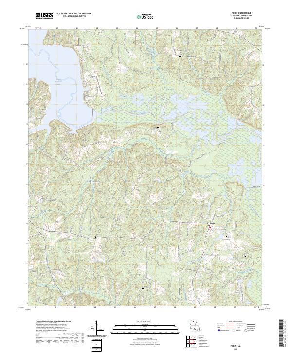
2024 Map of Point
USGS Topo · Published 2024About this map
The lowlands of Union Parish are defined here by the expansive waters of Bayou D'Arbonne Lake and the dense wetlands of the D'Arbonne National Wildlife Refuge. This landscape is a complex network of moving water, including the winding Bayou D'Arbonne and numerous tributaries such as Francis Creek, Tiger Creek, and Briny Bridge Creek. The small community of Point serves as the primary settlement hub in the eastern portion of the map, surrounded by family-named landmarks and rural burial grounds that speak to the area's deep genealogical roots. Several significant cemeteries, such as Ruggs Bluff Cem and Shady Grove Cem, are distributed throughout the parish, often situated on the higher ground near historical homesteads. Infrastructure like the Union Parish Airport and a grid of parish roads, including Mosleys Bluff Rd, provide access to this wooded and water-carved terrain.
Find a feature on this map
87 named features on this map. Tap any name to fly to it.
Don’t see what you’re looking for? This feature index may not catch every label — zoom into the map to look around manually.
Map Details
Editions of this 2024 Point Map
This is the sole edition of this map. No revisions or reprints were ever made.
Other maps of this area

1935 · Drew
USGS Topo · 1:62,500

1935 · Haile
USGS Topo · 1:62,500

1952 · Calhoun
USGS Topo · 1:62,500

1952 · Farmerville
USGS Topo · 1:62,500

1955 · Shreveport
USGS Topo · 1:250,000

1956 · Shreveport
USGS Topo · 1:250,000

1956 · Haile
USGS Topo · 1:62,500

1957 · Monroe North
USGS Topo · 1:62,500

1957 · West Monroe North
USGS Topo · 1:24,000
1969 · Monroe North
USGS Topo · 1:62,500