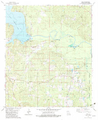
1982 Map of Point
USGS Topo · Published 1982About this map
The waters of D'Arbonne Lake and the winding Bayou D'Arbonne dominate this Union Parish landscape, illustrating the critical role of the drainage basin in northern Louisiana's geography. The map detail highlights the eastern extent of the D'Arbonne National Wildlife Refuge, where numerous tributaries like Lick Creek and Briny Creek feed into the bottomlands. Small rural communities such as Point and Wilhite anchor the upland areas, surrounded by family and community landmarks like Shady Grove Cem and Mt Arrat Ch.
Find a feature on this map
42 named features on this map. Tap any name to fly to it.
Don’t see what you’re looking for? This feature index may not catch every label — zoom into the map to look around manually.
Map Details
Editions of this 1982 Point Map
This is the sole edition of this map. No revisions or reprints were ever made.
Other maps of this area

1935 · Drew
USGS Topo · 1:62,500

1935 · Haile
USGS Topo · 1:62,500

1952 · Calhoun
USGS Topo · 1:62,500

1952 · Farmerville
USGS Topo · 1:62,500

1955 · Shreveport
USGS Topo · 1:250,000

1956 · Shreveport
USGS Topo · 1:250,000

1956 · Haile
USGS Topo · 1:62,500

1957 · Monroe North
USGS Topo · 1:62,500

1957 · West Monroe North
USGS Topo · 1:24,000
1969 · Monroe North
USGS Topo · 1:62,500