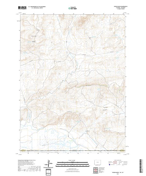
2021 Map of Poison Basin
USGS Topo · Published 2021About this map
Poison Basin dominates this landscape along the Wyoming-Colorado border, where the high desert terrain of Carbon County meets Moffat County. The area's complex water management history is written into the land through a dense network of irrigation channels, including the Home Ditch, Darr Ditch, and Woodbury Ditch, all drawing from the Little Snake River in the southern portion of the quadrangle. This infrastructure supported ranching in an arid environment punctuated by distinct geological formations like the Poison Buttes and Red Creek Rim.
Find a feature on this map
40 named features on this map. Tap any name to fly to it.
Don’t see what you’re looking for? This feature index may not catch every label — zoom into the map to look around manually.
Map Details
Editions of this 2021 Poison Basin Map
This is the sole edition of this map. No revisions or reprints were ever made.
Other maps of this area

1916 · Craig
USGS Topo · 1:125,000

1954 · Rawlins
USGS Topo · 1:250,000

1954 · Craig
USGS Topo · 1:250,000

1957 · Craig
USGS Topo · 1:250,000

1957 · Baggs
USGS Topo · 1:62,500

1958 · Rawlins
USGS Topo · 1:250,000

1958 · Craig
USGS Topo · 1:250,000

1960 · Craig
USGS Topo · 1:250,000

1962 · Rawlins
USGS Topo · 1:250,000

1962 · Craig
USGS Topo · 1:250,000