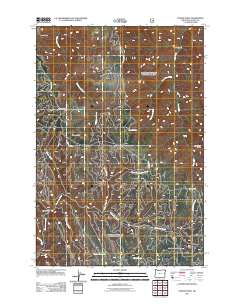
2011 Map of Poison Point
USGS Topo · Published 2011About this map
Bear Ridge and Hilton Ridge define the high-altitude terrain of this corner of Wallowa County, where a complex network of drainage systems feeds into the regional watershed. This 2011 survey illustrates a landscape carved by numerous waterways, including the winding paths of Chesnimnus Creek, Summit Creek, and Devils Run Creek. The topography is marked by significant landmarks like Poison Point and Fairchild Point, which overlook deep depressions such as Big Canyon and Wild Canyon. Isolated water sources like Howard Spring and Mitchell Spring are critical points in this upland environment, while the Cutout Reservoir represents a managed water feature near the southern boundary. A limited road network, including Buckhorn Rd and Cold Springs Rd, provides the primary access through this remote forest and rangeland.
Find a feature on this map
24 named features on this map. Tap any name to fly to it.
Don’t see what you’re looking for? This feature index may not catch every label — zoom into the map to look around manually.
Map Details
Editions of this 2011 Poison Point Map
This is the sole edition of this map. No revisions or reprints were ever made.
Other maps of this area

1954 · Imnaha
USGS Topo · 1:62,500

1955 · Grangeville
USGS Topo · 1:250,000

1957 · Elk Mountain
USGS Topo · 1:62,500

1959 · Grangeville
USGS Topo · 1:250,000

1963 · Deadhorse Ridge
USGS Topo · 1:24,000

1963 · Jim Creek Butte
USGS Topo · 1:24,000

1963 · Wapshilla Creek
USGS Topo · 1:24,000

1963 · Poison Point
USGS Topo · 1:24,000
1967 · Billy Meadows
USGS Topo · 1:24,000
1967 · Teepee Butte
USGS Topo · 1:24,000