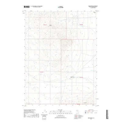
2018 Map of Poker Brown
USGS Topo · Published 2018About this map
The Majuba Mountains and the Trinity Range define the high-elevation relief of this corner of Pershing County. This part of the Great Basin is characterized by its drainage patterns, with Cavanaugh Wash and Poker Brown Wash channeling seasonal runoff through the basins. The settlement of Poker Brown serves as a primary geographic marker in a landscape otherwise dominated by expansive terrain and scattered water sources like Cavanaugh Spring. This 2018 survey detail provides a clear look at the township and range divisions, specifically where the border of the Humboldt Valley transitions into the upland ranges. The interplay between the alluvial washes and the mountain slopes illustrates the classic basin-and-range topography that has historically influenced travel and land use in this part of Nevada.
Find a feature on this map
12 named features on this map. Tap any name to fly to it.
Don’t see what you’re looking for? This feature index may not catch every label — zoom into the map to look around manually.
Map Details
Editions of this 2018 Poker Brown Map
This is the sole edition of this map. No revisions or reprints were ever made.
Other maps of this area

1931 · Lovelock
USGS Topo · 1:250,000

1935 · Lovelock
USGS Topo · 1:250,000

1955 · Lovelock
USGS Topo · 1:250,000

1956 · Oreana
USGS Topo · 1:62,500

1959 · Lovelock
USGS Topo · 1:250,000

1971 · Majuba Mtn
USGS Topo · 1:24,000

1971 · Rye Patch Reservoir South
USGS Topo · 1:24,000

1971 · Poker Brown
USGS Topo · 1:24,000

1971 · Rye Patch Reservoir North
USGS Topo · 1:24,000

1981 · Scossa
USGS Topo · 1:24,000