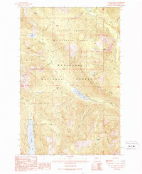
1989 Map of Polallie Ridge
USGS Topo · Published 1989About this map
Alpine Lakes Wilderness Area dominates this high-elevation landscape within the Wenatchee National Forest, defined by a network of glacial lakes and steep ridges. The Pacific Crest National Scenic Trail traverses the northern section, crossing through Waptus Pass and skirting Lemah Creek beneath Island Mountain. This map documents a critical recreational corridor before many contemporary trail realignments, centered on significant water bodies like Waptus Lake and Cooper Lake. The terrain is marked by prominent landforms such as Polallie Ridge and No Name Ridge, which channel the Cooper River and Kachess River. This provisional survey provides a look at the backcountry infrastructure of the late 1980s, including the Owh Campground and various pack trails used for wilderness access.
Find a feature on this map
39 named features on this map. Tap any name to fly to it.
Don’t see what you’re looking for? This feature index may not catch every label — zoom into the map to look around manually.
Map Details
Editions of this 1989 Polallie Ridge Map
2 editions found
Other maps of this area

1901 · Snoqualmie Pass
USGS Topo · 1:125,000

1902 · Skykomish
USGS Topo · 1:125,000

1903 · Snoqualmie
USGS Topo · 1:125,000

1905 · Skykomish
USGS Topo · 1:125,000

1957 · Wenatchee
USGS Topo · 1:250,000

1961 · Snoqualmie Pass
USGS Topo · 1:62,500

1961 · Kachess Lake
USGS Topo · 1:62,500

1965 · Mount Daniel
USGS Topo · 1:24,000
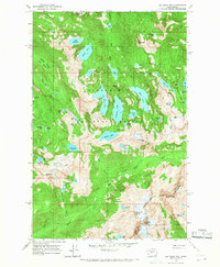
1965 · Big Snow Mtn
USGS Topo · 1:24,000
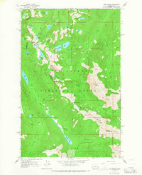
1965 · The Cradle
USGS Topo · 1:24,000