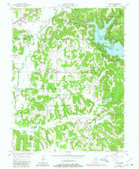
1957 Map of Poland
USGS Topo · Published 1980About this map
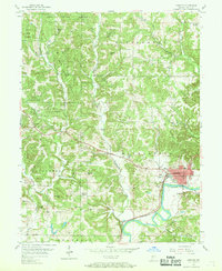
The Eel River and the newly established Cagles Mill Lake dominate this mid-century landscape where Owen, Putnam, and Clay counties meet. The introduction of the reservoir transformed the local geography, creating the Middle Narrows and surrounding the Richard Lieber State Park recreational areas. Despite these modern engineering changes, the traditional rural fabric remains visible through small centers like Poland and Jordan, and the persistent crossroads at Raab Crossroads. Genealogists will find a wealth of burial sites including McCullough Cem, Nier Cem, and the Wilkerson Cem near the Allemeyer Branch. The map also captures the local community infrastructure of the era, from the Township Sch to several country churches like Zion Ch and Oak Grove Ch, alongside organized retreats like Krietenstein Camp and Camp Na-Wa-Kwa.
Find a feature on this map
60 named features on this map. Tap any name to fly to it.
Don’t see what you’re looking for? This feature index may not catch every label — zoom into the map to look around manually.
Map Details
Editions of this 1957 Poland Map
4 editions found
Other maps of this area

1908 · Clay City
USGS Topo · 1:48,000

1910 · Clay City
USGS Topo · 1:62,500

1950 · Brazil East
USGS Topo · 1:24,000

1952 · Reelsville
USGS Topo · 1:24,000

1953 · Indianapolis
USGS Topo · 1:250,000

1956 · Indianapolis
USGS Topo · 1:250,000

1956 · Cloverdale
USGS Topo · 1:24,000

1956 · Cataract
USGS Topo · 1:24,000

1956 · Patricksburg
USGS Topo · 1:24,000
1956 · Spencer
USGS Topo · 1:24,000