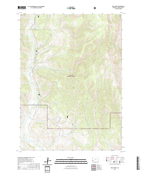
2021 Map of Pole Creek
USGS Topo · Published 2021About this map
The Bridger National Forest dominates this section of Lincoln County, where the high ridges of the Tunp Range and Commissary Ridge dictate the flow of numerous mountain streams. The drainage network is complex, with the Hams Fork and its tributaries, such as the E Fork Hams Fork and Shingle Mill Cr, carving through the steep topography. To the east, the headwaters of Pole Cr and W Fork Beaver Cr emerge from the slopes of Indian Ridge.
Find a feature on this map
35 named features on this map. Tap any name to fly to it.
Don’t see what you’re looking for? This feature index may not catch every label — zoom into the map to look around manually.
Map Details
Editions of this 2021 Pole Creek Map
This is the sole edition of this map. No revisions or reprints were ever made.
Other maps of this area

1936 · Cokeville
USGS Topo · 1:96,000

1942 · Cokeville
USGS Topo · 1:125,000

1955 · Preston
USGS Topo · 1:250,000

1958 · Preston
USGS Topo · 1:250,000

1962 · Preston
USGS Topo · 1:250,000
1967 · Pole Creek
USGS Topo · 1:24,000

1967 · Devils Hole Creek
USGS Topo · 1:24,000

1967 · Big Park
USGS Topo · 1:24,000
1967 · Wilkinson Creek
USGS Topo · 1:24,000
1967 · Sublette Canyon
USGS Topo · 1:24,000