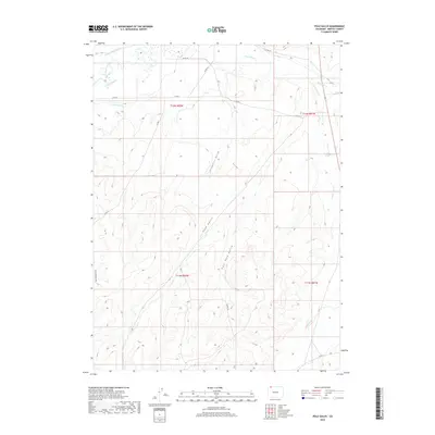
2019 Map of Pole Gulch
USGS Topo · Published 2019About this map
The Little Snake River defines the northern edge of this high-desert landscape in Moffat County, where a network of early irrigation infrastructure remains visible. These water management systems, including the Gibson Blair Ditch, W Side Canal, and Trowel Ditch, illustrate the efforts to sustain agriculture in the arid terrain south of the Wyoming border. The topography is dominated by a complex system of seasonal drainages and ravines, most notably Pole Gulch and East Pole Gulch, which carve through the land alongside Gledhill Draw. To the east, the drainage of Timberlake Cr marks the boundary between the R92W and R91W townships. This modern survey provides a detailed record of the unimproved roads like Co RD 4 and Co RD 9 that provide access through these remote public and private land parcels.
Find a feature on this map
22 named features on this map. Tap any name to fly to it.
Don’t see what you’re looking for? This feature index may not catch every label — zoom into the map to look around manually.
Map Details
Editions of this 2019 Pole Gulch Map
This is the sole edition of this map. No revisions or reprints were ever made.
Other maps of this area

1916 · Craig
USGS Topo · 1:125,000

1954 · Rawlins
USGS Topo · 1:250,000

1954 · Craig
USGS Topo · 1:250,000

1957 · Craig
USGS Topo · 1:250,000

1957 · Baggs
USGS Topo · 1:62,500

1958 · Rawlins
USGS Topo · 1:250,000

1958 · Craig
USGS Topo · 1:250,000

1960 · Craig
USGS Topo · 1:250,000

1962 · Rawlins
USGS Topo · 1:250,000

1962 · Craig
USGS Topo · 1:250,000