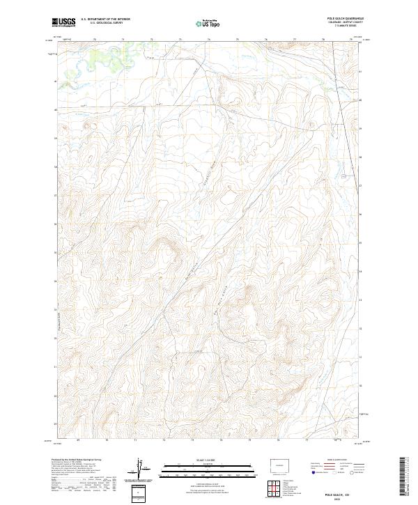
2022 Map of Pole Gulch
USGS Topo · Published 2022About this map
The Little Snake River defines the northwestern corner of this territory, where early 21st-century irrigation infrastructure like the Gibson Blair Ditch, Trowel Ditch, and W Side Canal reveal the vital role of water management in the arid Colorado basin. The landscape is carved by significant drainage systems, notably Pole Gulch and East Pole Gulch, which dominate the central terrain. This Moffat County quadrangle illustrates a rural network of county roads, including Co RD 9w and Co RD 4, connecting family-named landmarks and local drainages. The mapping of Gledhill Draw and Thornburgh Gulch alongside seasonal watercourses like Fourmile Cr and Timberlake Cr provides a clear view of the complex topographical features and land divisions in this part of Northwest Colorado.
Find a feature on this map
22 named features on this map. Tap any name to fly to it.
Don’t see what you’re looking for? This feature index may not catch every label — zoom into the map to look around manually.
Map Details
Editions of this 2022 Pole Gulch Map
This is the sole edition of this map. No revisions or reprints were ever made.
Other maps of this area

1916 · Craig
USGS Topo · 1:125,000

1954 · Rawlins
USGS Topo · 1:250,000

1954 · Craig
USGS Topo · 1:250,000

1957 · Craig
USGS Topo · 1:250,000

1957 · Baggs
USGS Topo · 1:62,500

1958 · Rawlins
USGS Topo · 1:250,000

1958 · Craig
USGS Topo · 1:250,000

1960 · Craig
USGS Topo · 1:250,000

1962 · Rawlins
USGS Topo · 1:250,000

1962 · Craig
USGS Topo · 1:250,000