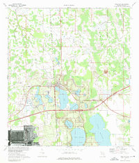
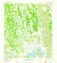
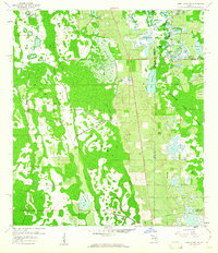
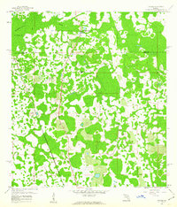
1975 Map of Polk City
USGS Topo · Published 1976About this map
The Green Swamp dominates the northern landscape of this mid-1970s survey, illustrating the complex hydrology of Central Florida before extensive modern development. Polk City serves as the primary hub, situated at the intersection of critical transit corridors including the Seaboard Coast Line railroad and several primary highways. The area is defined by its numerous water bodies, ranging from the large Lake Juliana and Lake Mattie in the south to smaller basins like Lake Agnes and Clearwater Lake.
Find a feature on this map
24 named features on this map. Tap any name to fly to it.
Don’t see what you’re looking for? This feature index may not catch every label — zoom into the map to look around manually.
Map Details
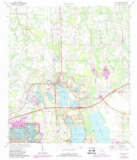
Editions of this 1975 Polk City Map
2 editions found
Other maps of this area
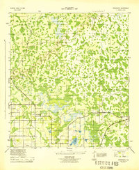
1944 · Providence
USGS Topo · 1:31,680
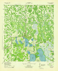
1944 · Polk City
USGS Topo · 1:31,680

1944 · Lakeland
USGS Topo · 1:31,680

1944 · Auburndale
USGS Topo · 1:31,680

1955 · Orlando
USGS Topo · 1:250,000

1957 · Orlando
USGS Topo · 1:250,000

1958 · Orlando
USGS Topo · 1:250,000
1959 · Gum Lake
USGS Topo · 1:24,000
1959 · Lake Louisa SW
USGS Topo · 1:24,000
1959 · Poyner
USGS Topo · 1:24,000