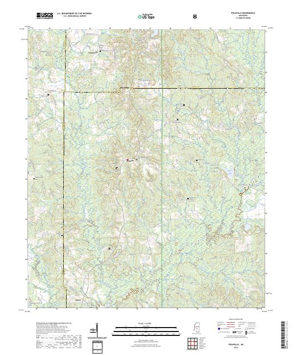
2024 Map of Polkville
USGS Topo · Published 2024About this map
Polkville serves as a central junction within this rural landscape where the border of Rankin, Smith, and Scott counties meets. The area is defined by a dense network of country roads like Gray Rd and Woodrow Martin Rd that connect small settlements and numerous family-named burial grounds. To the east, the Bienville National Forest covers a significant portion of the terrain, protecting the headwaters and tributaries that feed into the Strong River. Local history is deeply etched into the land through sites such as the Old Polkville Cem and Old Stubbs Cem, alongside established spiritual centers like the Cooperville Baptist Church. The drainage patterns of Raspberry Creek and Davis Creek illustrate the natural topography that shaped the early development of Cooperville and Daniel.
Find a feature on this map
84 named features on this map. Tap any name to fly to it.
Don’t see what you’re looking for? This feature index may not catch every label — zoom into the map to look around manually.
Map Details
Editions of this 2024 Polkville Map
This is the sole edition of this map. No revisions or reprints were ever made.
Other maps of this area

1922 · Morton
USGS Topo · 1:48,000

1922 · Pelahatchee
USGS Topo · 1:48,000

1924 · Pelahatchee
USGS Topo · 1:62,500

1924 · Morton
USGS Topo · 1:62,500

1935 · White Oak
USGS Topo · 1:24,000

1950 · Pelahatchie
USGS Topo · 1:62,500

1951 · Morton
USGS Topo · 1:62,500

1952 · Pelahatchie
USGS Topo · 1:62,500

1953 · Meridian
USGS Topo · 1:250,000

1957 · Meridian
USGS Topo · 1:250,000