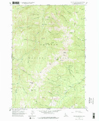
1963 Map of Pollock Mountain
USGS Topo · Published 1977About this map
Pollock Mountain dominates this high-country survey of the Payette National Forest in Adams County, where the topography is defined by the steep drainage basins of the Rapid River and its numerous tributaries. Human presence in this mid-century wilderness is marked by transient resource extraction and seasonal grazing sites, evidenced by the Black Leopard Discovery Mine and several scattered camps such as Campbells Cow Camp and Star Creek Camp. A solitary Grave is noted near Lonesome Creek, providing a somber reminder of the area's isolation. The network of pack trails, including the aptly named Devils Ladder, connects remote landmarks like the Lookout and Paradise Cabin. The map reveals an era of forest management and early mineral exploration, documenting specific locations like Shannon Corral and the Smoky Forest Camp before modern infrastructure reached these high basins.
Find a feature on this map
89 named features on this map. Tap any name to fly to it.
Don’t see what you’re looking for? This feature index may not catch every label — zoom into the map to look around manually.
Map Details
Editions of this 1963 Pollock Mountain Map
3 editions found
Other maps of this area

1920 · Seven Devils Mining District
USGS Topo · 1:48,000

1922 · He Devil
USGS Topo · 1:48,000

1938 · Riggins
USGS Topo · 1:96,000

1945 · Riggins
USGS Topo · 1:125,000

1955 · Grangeville
USGS Topo · 1:250,000

1957 · He Devil
USGS Topo · 1:62,500

1957 · Cuprum
USGS Topo · 1:62,500

1959 · Grangeville
USGS Topo · 1:250,000

1963 · Bally Mountain
USGS Topo · 1:24,000

1963 · Indian Mountain
USGS Topo · 1:24,000