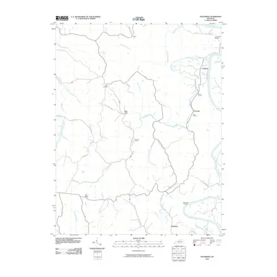
2010 Map of Polsgrove
USGS Topo · Published 2010About this map
The Kentucky River snakes along the eastern edge of this landscape, defining the rural character of Franklin County. Long-standing local family history is anchored by burial grounds such as Bailey Cemetery, Hutcherson Cemetery, and Moore Cemetery, which sit among the rolling creek valleys. The settlement pattern follows the drainage of Flat Creek and its many tributaries, with small communities like Polsgrove, Ottusville, and Flag Fork serving as local landmarks.
Find a feature on this map
43 named features on this map. Tap any name to fly to it.
Don’t see what you’re looking for? This feature index may not catch every label — zoom into the map to look around manually.
Map Details
Editions of this 2010 Polsgrove Map
This is the sole edition of this map. No revisions or reprints were ever made.
Other maps of this area

1906 · Lockport
USGS Topo · 1:48,000

1908 · Lockport
USGS Topo · 1:62,500

1922 · Frankfort
USGS Topo · 1:48,000

1923 · Waddy
USGS Topo · 1:48,000

1924 · Frankfort
USGS Topo · 1:62,500

1925 · Mount Eden
USGS Topo · 1:48,000

1927 · Mount Eden
USGS Topo · 1:62,500

1928 · New Castle
USGS Topo · 1:48,000

1932 · New Castle
USGS Topo · 1:62,500

1953 · Monterey
USGS Topo · 1:24,000