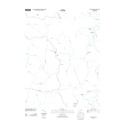
2013 Map of Polsgrove
USGS Topo · Published 2013About this map
The Kentucky River winds through the eastern portion of this landscape, defining a series of low-lying areas such as Lecompte Bottom, Polsgrove Bottom, and Scotts Bottom. This riverine geography historically dictated the placement of early settlements and crossings, including the eponymous Polsgrove and the landmark Harpers Ferry to the north. Further inland, the terrain transitions to a network of ridges and hollows, where small communities like Flag Fork, Ottusville, and Harvieland are connected by winding routes such as Harp Pike Rd and Lebanon Ridge Rd.
Find a feature on this map
57 named features on this map. Tap any name to fly to it.
Don’t see what you’re looking for? This feature index may not catch every label — zoom into the map to look around manually.
Map Details
Editions of this 2013 Polsgrove Map
This is the sole edition of this map. No revisions or reprints were ever made.
Other maps of this area

1906 · Lockport
USGS Topo · 1:48,000

1908 · Lockport
USGS Topo · 1:62,500

1922 · Frankfort
USGS Topo · 1:48,000

1923 · Waddy
USGS Topo · 1:48,000

1924 · Frankfort
USGS Topo · 1:62,500

1925 · Mount Eden
USGS Topo · 1:48,000

1927 · Mount Eden
USGS Topo · 1:62,500

1928 · New Castle
USGS Topo · 1:48,000

1932 · New Castle
USGS Topo · 1:62,500

1953 · Monterey
USGS Topo · 1:24,000