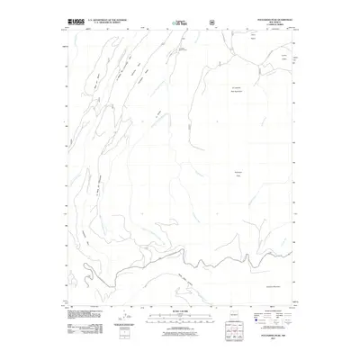
2011 Map of Polvadera Peak
USGS Topo · Published 2011About this map
Polvadera Sawmill Camp sits at the northern edge of this high-elevation landscape, representing a rare point of human habitation among the mesas and canyons of the Santa Fe National Forest. The terrain is dominated by volcanic features and significant relief, anchored by the massive Chicoma Mountain in the south and the prominent Polvadera Peak to the north. A network of high mesas, including Polvadera Mesa and Mesa del Medio, are carved by deep drainages like Cañoncito Seco and the headwaters of Santa Clara Creek. The map documents a complex hydrological system where water flows through steep features such as Santa Clara Canyon and along Abiquiu Creek. This 2011 survey captures the area's essential geographic character, from named cinder cones like Cerro Pelon to the remote seasonal camp at Polvadera Sawmill Camp.
Find a feature on this map
27 named features on this map. Tap any name to fly to it.
Don’t see what you’re looking for? This feature index may not catch every label — zoom into the map to look around manually.
Map Details
Editions of this 2011 Polvadera Peak Map
This is the sole edition of this map. No revisions or reprints were ever made.
Other maps of this area

1890 · Jemes
USGS Topo · 1:125,000

1892 · Jemes
USGS Topo · 1:125,000

1892 · Santa Clara
USGS Topo · 1:125,000

1909 · Gallina
USGS Topo · 1:125,000

1918 · Abiquiu
USGS Topo · 1:125,000

1937 · Jemez Springs
USGS Topo · 1:48,000

1944 · Jemez Springs
USGS Topo · 1:62,500

1952 · Valle Toledo
USGS Topo · 1:24,000

1952 · Jemez Springs
USGS Topo · 1:62,500

1952 · Guaje Mountain
USGS Topo · 1:24,000