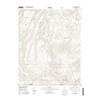
2013 Map of Polvadera Peak
USGS Topo · Published 2013About this map
Polvadera Peak and Chicoma Mtn anchor this high-elevation landscape within the Santa Fe National Forest. The map documents a rugged terrain of mesas and deep drainages at the boundary of Rio Arriba and Sandoval counties. Historical land use and resource management are evident through features like the Polvadera Sawmill Camp and the Road Mesa Trick Tank, reflecting the area's history of logging and water management for livestock or wildlife. Numerous waterways, including Polvadera Creek, Abiquiu Cr, and the headwaters of Santa Clara Cr, carve through the complex topography of Polvadera Mesa and the Santa Clara Canyon. Small settlements or localities such as La Mesita, La Terrera, and El Cañoncito are situated along the lower slopes and access roads like Polvadera Rd and State Hwy 565.
Find a feature on this map
38 named features on this map. Tap any name to fly to it.
Don’t see what you’re looking for? This feature index may not catch every label — zoom into the map to look around manually.
Map Details
Editions of this 2013 Polvadera Peak Map
This is the sole edition of this map. No revisions or reprints were ever made.
Other maps of this area

1890 · Jemes
USGS Topo · 1:125,000

1892 · Jemes
USGS Topo · 1:125,000

1892 · Santa Clara
USGS Topo · 1:125,000

1909 · Gallina
USGS Topo · 1:125,000

1918 · Abiquiu
USGS Topo · 1:125,000

1937 · Jemez Springs
USGS Topo · 1:48,000

1944 · Jemez Springs
USGS Topo · 1:62,500

1952 · Valle Toledo
USGS Topo · 1:24,000

1952 · Jemez Springs
USGS Topo · 1:62,500

1952 · Guaje Mountain
USGS Topo · 1:24,000