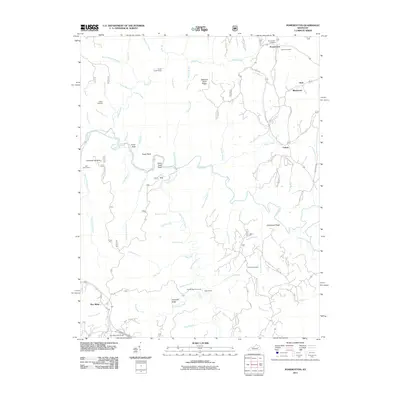
2011 Map of Pomeroyton
USGS Topo · Published 2011About this map
Pomeroyton serves as a primary settlement point in this area of Wolfe County, where the landscape is defined by the winding course of the Red River and its numerous tributaries. The terrain is notably marked by distinctive geological formations such as Chimney Top Rock, Tower Rock, and the Indian Stairway, indicating a region of significant elevation changes and sandstone outcrops. Small communities and family-named ridges like Campbell Ridge and Calaboose Ridge are connected by a network of backroads, including Calaboose Ridge Rd and Chimney Top Rock Rd. Local heritage is anchored by several burial grounds, including the Pomeroyton Cemetery, Catron Cemetery, and Center Cemetery. The mapping also highlights the hydrological complexity of the area, from the larger Swift Camp Creek to smaller drainages like Parched Corn Creek and Whites Branch, which have carved deep into the local geology to create features like Rock Bridge Falls.
Find a feature on this map
84 named features on this map. Tap any name to fly to it.
Don’t see what you’re looking for? This feature index may not catch every label — zoom into the map to look around manually.
Map Details
Editions of this 2011 Pomeroyton Map
This is the sole edition of this map. No revisions or reprints were ever made.
Other maps of this area

1889 · Salyersville
USGS Topo · 1:125,000

1891 · Salyersville
USGS Topo · 1:125,000

1892 · Beattyville
USGS Topo · 1:125,000

1899 · Salyersville
USGS Topo · 1:125,000

1951 · Landsaw
USGS Topo · 1:24,000

1951 · Ezel
USGS Topo · 1:24,000

1951 · Hazel Green
USGS Topo · 1:24,000

1951 · Pomeroyton
USGS Topo · 1:24,000

1952 · Scranton
USGS Topo · 1:24,000

1952 · Frenchburg
USGS Topo · 1:24,000