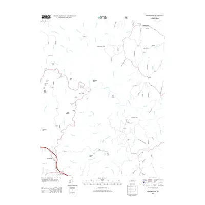
2013 Map of Pomeroyton
USGS Topo · Published 2013About this map
Pomeroyton and Blackwater anchor the northern landscape of this Wolfe County region, where the deeply incised drainage of the Red River has sculpted an extraordinary collection of natural spans and rock formations. The mapping detail highlights a concentration of geological landmarks such as Sky Bridge, Castle Arch, and the Silvermine Arch, which characterize the high-relief terrain between Osborne Bend Ridge and Calaboose Ridge. Small family and community landmarks like Catron Cem and Pomeroyton Cem are preserved alongside the modern corridor of the Bert T Combs Mtn Pkwy, which terminates at the Pine Ridge Interchange in the southwest. This area, marked by complex watercourses like Gladie Cr and Swift Camp Cr, shows the long-standing reliance on ridge-top roads such as Lawson Ridge Rd and Jump Off Ridge Rd to navigate the intricate network of cliffs and hollows.
Find a feature on this map
103 named features on this map. Tap any name to fly to it.
Don’t see what you’re looking for? This feature index may not catch every label — zoom into the map to look around manually.
Map Details
Editions of this 2013 Pomeroyton Map
This is the sole edition of this map. No revisions or reprints were ever made.
Other maps of this area

1889 · Salyersville
USGS Topo · 1:125,000

1891 · Salyersville
USGS Topo · 1:125,000

1892 · Beattyville
USGS Topo · 1:125,000

1899 · Salyersville
USGS Topo · 1:125,000

1951 · Landsaw
USGS Topo · 1:24,000

1951 · Ezel
USGS Topo · 1:24,000

1951 · Hazel Green
USGS Topo · 1:24,000

1951 · Pomeroyton
USGS Topo · 1:24,000

1952 · Scranton
USGS Topo · 1:24,000

1952 · Frenchburg
USGS Topo · 1:24,000