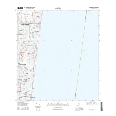
2015 Map of Pompano Beach
USGS Topo · Published 2015About this map
The Intracoastal Waterway defines this stretch of the Florida coast, separating the mainland from a dense chain of barrier island developments and oceanfront neighborhoods. This 2015 survey illustrates the intricate engineering of the Gold Coast, where the Pompano Canal and Cypress Creek Canal feed into a network of finger islands and residential waterways like Garden Isles, Pompano Isles, and Nurmi Isles. The landscape is dominated by leisure and residential planning, featuring established enclaves such as Sea Ranch Lakes and Lauderdale-by-the-Sea. Inland, the footprint of the Pompano Beach Airpark and the Star of David Memorial Gardens provide significant landmarks. These man-made canals and bridges, including the Atlantic Pompano Bridge and Sunrise Bridge, show the complete transformation of the Atlantic shoreline into a modern maritime corridor.
Find a feature on this map
60 named features on this map. Tap any name to fly to it.
Don’t see what you’re looking for? This feature index may not catch every label — zoom into the map to look around manually.
Map Details
Editions of this 2015 Pompano Beach Map
This is the sole edition of this map. No revisions or reprints were ever made.
Other maps of this area

1945 · Fort Lauderdale North
USGS Topo · 1:24,000

1946 · West Dixie Bend
USGS Topo · 1:24,000

1946 · Boca Raton
USGS Topo · 1:24,000

1949 · Fort Lauderdale North
USGS Topo · 1:24,000

1949 · West Dixie Bend
USGS Topo · 1:24,000

1949 · Port Everglades
USGS Topo · 1:24,000

1949 · Fort Lauderdale South
USGS Topo · 1:24,000

1949 · Pompano Beach
USGS Topo · 1:24,000

1950 · Boca Raton
USGS Topo · 1:24,000

1956 · West Palm Beach
USGS Topo · 1:250,000
Featured Places
- Fort Lauderdale, FL
- Pompano Beach, FL
- Lauderdale-by-the-Sea, FL
- Sea Ranch Lakes, FL
- Cypress Isles Estates, Pompano Beach