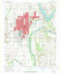
1968 Map of Ponca City
USGS Topo · Published 1970About this map
Arkansas River and its tributary, the Salt Fork Arkansas River, define the southern geography of this industrial and agricultural landscape in the late 1960s. The region is anchored by the extensive Oil Refinery and adjacent Tank Farm south of Ponca City, marking the area’s deep ties to the petroleum industry. This legacy extends eastward into the Big Bend Oil Field and Oil Field labels scattered across the terrain.
Find a feature on this map
59 named features on this map. Tap any name to fly to it.
Don’t see what you’re looking for? This feature index may not catch every label — zoom into the map to look around manually.
Map Details
Editions of this 1968 Ponca City Map
2 editions found
Other maps of this area

1935 · Kaw
USGS Topo · 1:62,500

1936 · Belford
USGS Topo · 1:62,500

1955 · Enid
USGS Topo · 1:250,000

1958 · Enid
USGS Topo · 1:250,000

1963 · Charley Creek
USGS Topo · 1:24,000

1963 · Uncas
USGS Topo · 1:24,000

1968 · Marland
USGS Topo · 1:24,000

1968 · Ponca City NW
USGS Topo · 1:24,000

1968 · Ponca City SE
USGS Topo · 1:24,000

1968 · Kildare
USGS Topo · 1:24,000