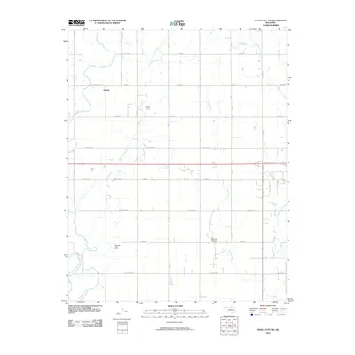
2010 Map of Ponca City NW
USGS Topo · Published 2010About this map
Autwine serves as the primary named settlement in this prairie landscape northwest of Ponca City, where the agricultural grid is defined by a network of section roads like W Hartford Ave and W Oakland Rd. The region's petroleum history is evident through the presence of the Autwine Oil Field and the Southwest Ponca City Oil Field, indicating the persistent role of energy extraction in the local economy.
Find a feature on this map
26 named features on this map. Tap any name to fly to it.
Don’t see what you’re looking for? This feature index may not catch every label — zoom into the map to look around manually.
Map Details
Editions of this 2010 Ponca City NW Map
This is the sole edition of this map. No revisions or reprints were ever made.
Other maps of this area

1955 · Enid
USGS Topo · 1:250,000

1958 · Enid
USGS Topo · 1:250,000

1968 · Tonkawa SE
USGS Topo · 1:24,000

1968 · Marland
USGS Topo · 1:24,000

1968 · Ponca City NW
USGS Topo · 1:24,000

1968 · Ponca City SE
USGS Topo · 1:24,000

1968 · Tonkawa
USGS Topo · 1:24,000

1968 · Kildare
USGS Topo · 1:24,000

1968 · Blackwell
USGS Topo · 1:24,000
1968 · Newkirk SW
USGS Topo · 1:24,000