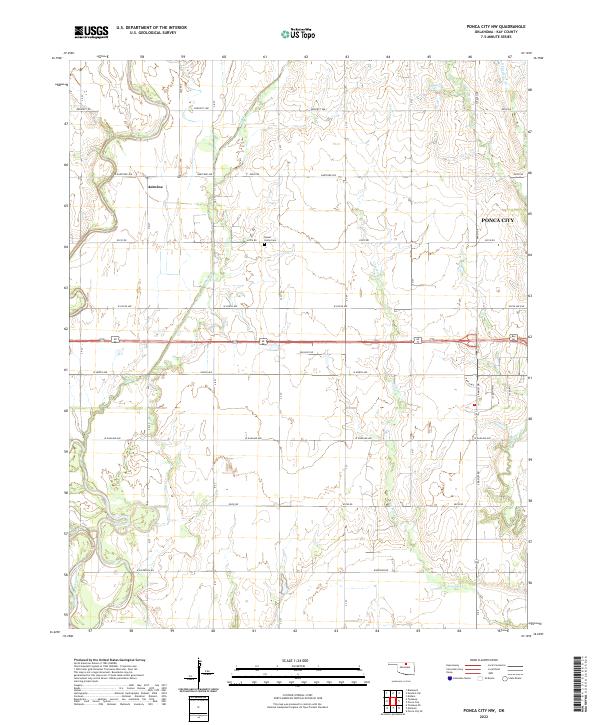
2022 Map of Ponca City NW
USGS Topo · Published 2022About this map
Autwine and the northwestern reaches of Ponca City define this northern Oklahoma landscape just after the turn of the 21st century. The terrain is characterized by a series of north-south drainage networks including Duck Creek, Cowskin Creek, and West Cattle Creek, which flow toward the southern boundary of the sheet. The far southwestern corner is marked by the meandering path of the Salt Fork Arkansas River.
Find a feature on this map
32 named features on this map. Tap any name to fly to it.
Don’t see what you’re looking for? This feature index may not catch every label — zoom into the map to look around manually.
Map Details
Editions of this 2022 Ponca City NW Map
This is the sole edition of this map. No revisions or reprints were ever made.
Other maps of this area

1955 · Enid
USGS Topo · 1:250,000

1958 · Enid
USGS Topo · 1:250,000

1968 · Tonkawa SE
USGS Topo · 1:24,000

1968 · Marland
USGS Topo · 1:24,000

1968 · Ponca City NW
USGS Topo · 1:24,000

1968 · Ponca City SE
USGS Topo · 1:24,000

1968 · Tonkawa
USGS Topo · 1:24,000

1968 · Kildare
USGS Topo · 1:24,000

1968 · Blackwell
USGS Topo · 1:24,000
1968 · Newkirk SW
USGS Topo · 1:24,000