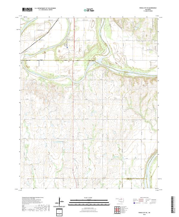
2022 Map of Ponca City SE
USGS Topo · Published 2022About this map
The Salt Fork Arkansas River carves a winding path through the northern half of this landscape, eventually joining the larger Arkansas River as it snakes along the Noble and Osage county line. This 2022 survey captures a rural Oklahoma terrain defined by its complex hydrology and the grid-like organization of the Public Land Survey System. Prominent elevation features like Cowboy Hill overlook a network of section line roads including W Cowboy Hill Rd and Klipard Rd. The southern reach of the quadrangle is marked by significant water management infrastructure, such as the Lower Red Rock Cr Site 3 Reservoir and the 103009 Reservoir. Local landmarks like the Badlands and several named creeks, including Houston Cr and Bird Cr, characterize the drainage patterns of this prairie region, providing a detailed look at the local geography of Noble and Kay counties.
Find a feature on this map
59 named features on this map. Tap any name to fly to it.
Don’t see what you’re looking for? This feature index may not catch every label — zoom into the map to look around manually.
Map Details
Editions of this 2022 Ponca City SE Map
This is the sole edition of this map. No revisions or reprints were ever made.
Other maps of this area

1930 · Pawnee
USGS Topo · 1:62,500

1936 · Belford
USGS Topo · 1:62,500

1936 · Pawnee
USGS Topo · 1:62,500

1955 · Enid
USGS Topo · 1:250,000

1958 · Enid
USGS Topo · 1:250,000

1963 · Charley Creek
USGS Topo · 1:24,000

1968 · Marland
USGS Topo · 1:24,000

1968 · Ponca City NW
USGS Topo · 1:24,000

1968 · Ponca City SE
USGS Topo · 1:24,000
1968 · Ponca City
USGS Topo · 1:24,000