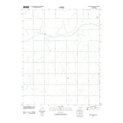
2010 Map of Pond Creek NW
USGS Topo · Published 2010About this map
The Salt Fork Arkansas River meanders across this northern Oklahoma landscape, defining the hydrology of a region where agriculture and community landmarks intersect. A network of section-line roads such as e0190 RD and n2830 RD provides the grid for rural life, connecting isolated points of interest like the Riverdale Community Hall in the northeast and the settlement of Four Corners in the east. This 2010 survey highlights a quiet, enduring rural structure, where the crossing at Hixson Bridge and the presence of the Friends Cemetery and Mount Zion Cemetery suggest long-established family ties to the land. The drainage patterns are dominated by numerous tributaries, including Coldwater Creek, Sand Creek, and Crooked Creek, which feed into the primary river valley, carving subtle variations into the prairie terrain.
Find a feature on this map
24 named features on this map. Tap any name to fly to it.
Don’t see what you’re looking for? This feature index may not catch every label — zoom into the map to look around manually.
Map Details
Editions of this 2010 Pond Creek NW Map
This is the sole edition of this map. No revisions or reprints were ever made.
Other maps of this area

1955 · Enid
USGS Topo · 1:250,000

1955 · Woodward
USGS Topo · 1:250,000

1958 · Enid
USGS Topo · 1:250,000

1958 · Woodward
USGS Topo · 1:250,000

1968 · Hillsdale
USGS Topo · 1:24,000

1968 · Wakita SE
USGS Topo · 1:24,000

1968 · Kremlin
USGS Topo · 1:24,000

1968 · Pond Creek
USGS Topo · 1:24,000

1968 · Pond Creek NW
USGS Topo · 1:24,000

1968 · Wakita SW
USGS Topo · 1:24,000