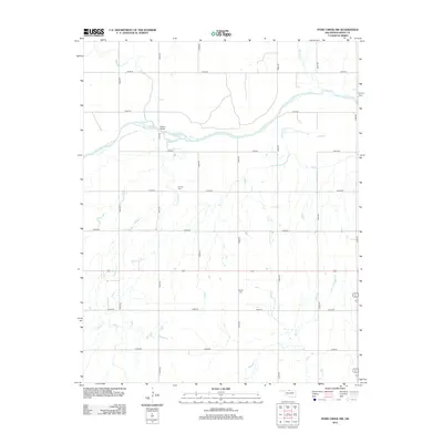
2012 Map of Pond Creek NW
USGS Topo · Published 2012About this map
The Salt Fork Arkansas River winds across this northern Oklahoma landscape, where a grid of rural roads defines the agricultural character of Grant County. Centered on Hixson Bridge, the terrain is defined by a dendritic network of seasonal waterways including Coldwater Cr, Sand Cr, and Spring Cr. This environment reflects the steady persistence of early 21st-century prairie life, where the land is organized into square-mile sections.
Find a feature on this map
21 named features on this map. Tap any name to fly to it.
Don’t see what you’re looking for? This feature index may not catch every label — zoom into the map to look around manually.
Map Details
Editions of this 2012 Pond Creek NW Map
This is the sole edition of this map. No revisions or reprints were ever made.
Other maps of this area

1955 · Enid
USGS Topo · 1:250,000

1955 · Woodward
USGS Topo · 1:250,000

1958 · Enid
USGS Topo · 1:250,000

1958 · Woodward
USGS Topo · 1:250,000

1968 · Hillsdale
USGS Topo · 1:24,000

1968 · Wakita SE
USGS Topo · 1:24,000

1968 · Kremlin
USGS Topo · 1:24,000

1968 · Pond Creek
USGS Topo · 1:24,000

1968 · Pond Creek NW
USGS Topo · 1:24,000

1968 · Wakita SW
USGS Topo · 1:24,000