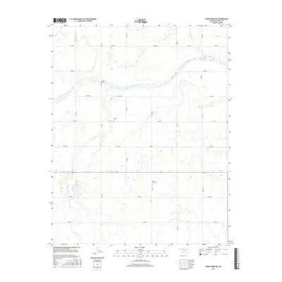
2016 Map of Pond Creek NW
USGS Topo · Published 2016About this map
The Salt Fork Arkansas River carves a braided path across this northern Oklahoma landscape, where the flat plains of Grant County meet a network of seasonal watercourses. The river is joined by Coldwater Creek near the center of the sheet, creating a complex drainage system that defines the local topography. This area is characterized by its rigid sectional grid of rural routes, such as Ellis Rd and Dewey Rd, which connect isolated homesteads and family landmarks. Cultural history is anchored by the Friends Cem and Mount Zion Cem, which serve as physical ties to the early farming communities that settled this prairie. Infrastructure like the Hixson Bridge provides a rare crossing point over the wider river channel, illustrating the challenges of travel across the watershed in this rural agricultural corridor.
Find a feature on this map
27 named features on this map. Tap any name to fly to it.
Don’t see what you’re looking for? This feature index may not catch every label — zoom into the map to look around manually.
Map Details
Editions of this 2016 Pond Creek NW Map
This is the sole edition of this map. No revisions or reprints were ever made.
Other maps of this area

1955 · Enid
USGS Topo · 1:250,000

1955 · Woodward
USGS Topo · 1:250,000

1958 · Enid
USGS Topo · 1:250,000

1958 · Woodward
USGS Topo · 1:250,000

1968 · Hillsdale
USGS Topo · 1:24,000

1968 · Wakita SE
USGS Topo · 1:24,000

1968 · Kremlin
USGS Topo · 1:24,000

1968 · Pond Creek
USGS Topo · 1:24,000

1968 · Pond Creek NW
USGS Topo · 1:24,000

1968 · Wakita SW
USGS Topo · 1:24,000