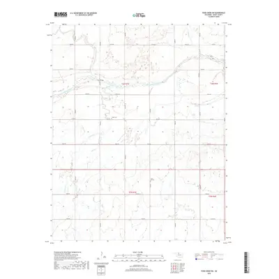
2018 Map of Pond Creek NW
USGS Topo · Published 2018About this map
The Salt Fork Arkansas River carves a broad, braided path across this portion of northern Oklahoma, defining a landscape of wide riverbottoms and rolling prairie. Crossing the river at Hixson Bridge, the terrain is marked by a strict section-line road grid that supports a long-established agricultural community. This 2018 survey reveals the persistent presence of local heritage sites, including the Friends Cem and Mount Zion Cem, which serve as landmarks for genealogists and local historians. Tributaries like Coldwater Creek, Sand Cr, and Spring Cr snake through the plains, often punctuated by small wetlands and intermittent ponds. The map provides a contemporary view of the intersection of township boundaries, including t26n r7w and t25n r6w, where rural life is organized along named corridors such as Garvin Rd and Grant Rd.
Find a feature on this map
31 named features on this map. Tap any name to fly to it.
Don’t see what you’re looking for? This feature index may not catch every label — zoom into the map to look around manually.
Map Details
Editions of this 2018 Pond Creek NW Map
This is the sole edition of this map. No revisions or reprints were ever made.
Other maps of this area

1955 · Enid
USGS Topo · 1:250,000

1955 · Woodward
USGS Topo · 1:250,000

1958 · Enid
USGS Topo · 1:250,000

1958 · Woodward
USGS Topo · 1:250,000

1968 · Hillsdale
USGS Topo · 1:24,000

1968 · Wakita SE
USGS Topo · 1:24,000

1968 · Kremlin
USGS Topo · 1:24,000

1968 · Pond Creek
USGS Topo · 1:24,000

1968 · Pond Creek NW
USGS Topo · 1:24,000

1968 · Wakita SW
USGS Topo · 1:24,000