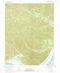
1967 Map of Pond Run
USGS Topo · Published 1991About this map
The Shawnee State Forest dominates this section of Scioto County, where deep hollows like Lampblack Hollow and Cotton Eye Hollow carve through the heavily dissected terrain. Along the northern edge, the waters of Turkey Creek Lake and Roosevelt Lake provide a focal point for recreation and local topography, while the Ohio River forms the southern boundary at Normal Pool Elevation 485. The map preserves the cultural footprint of isolated Appalachian communities, noting sites like the Mackletree Mission and the McKendree Ch.
Find a feature on this map
79 named features on this map. Tap any name to fly to it.
Don’t see what you’re looking for? This feature index may not catch every label — zoom into the map to look around manually.
Map Details
Editions of this 1967 Pond Run Map
3 editions found
Other maps of this area

1915 · Garrison
USGS Topo · 1:62,500

1915 · Otway
USGS Topo · 1:62,500

1916 · Peebles
USGS Topo · 1:62,500

1917 · Otway
USGS Topo · 1:62,500

1918 · Garrison
USGS Topo · 1:62,500

1918 · Peebles
USGS Topo · 1:62,500

1919 · Vanceburg
USGS Topo · 1:62,500

1949 · Pond Run
USGS Topo · 1:24,000

1949 · Vanceburg
USGS Topo · 1:62,500

1949 · Garrison
USGS Topo · 1:24,000