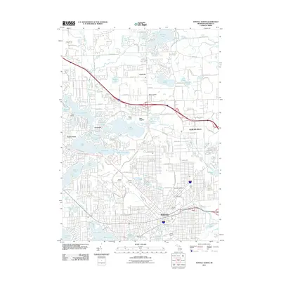
2011 Map of Pontiac North
USGS Topo · Published 2011About this map
The Clinton River winds through this detailed survey of northern Oakland County, connecting a dense network of glacial lakes including Lake Angelus and Lake Oakland. The transition from the urban grid of Pontiac to the surrounding suburban communities of Auburn Hills and Clintonville is clearly defined, showing the development patterns of the early twenty-first century. A significant local landmark, the McMath-Hulbert Observatory, stands near the northern shore of Lake Angelus, while the topography rises at Pine Knob and Mount Judah. Genealogists will find several major burial grounds documented, including the sprawling Oak Hill Cemetery and Mount Hope Cemetery near the city center. The map also records the varied recreation and industry of the area, from the Silver Lake Golf Course to the waters of Dawsons Millpond and Sylvan Lake in the south.
Find a feature on this map
71 named features on this map. Tap any name to fly to it.
Don’t see what you’re looking for? This feature index may not catch every label — zoom into the map to look around manually.
Map Details
Editions of this 2011 Pontiac North Map
This is the sole edition of this map. No revisions or reprints were ever made.
Other maps of this area

1907 · Pontiac
USGS Topo · 1:62,500

1908 · Rochester
USGS Topo · 1:62,500

1936 · Birmingham
USGS Topo · 1:31,680

1936 · Clarkston
USGS Topo · 1:31,680

1936 · Rochester
USGS Topo · 1:31,680

1936 · Walled Lake
USGS Topo · 1:31,680

1936 · Pontiac South
USGS Topo · 1:31,680

1936 · Pontiac North
USGS Topo · 1:31,680

1943 · Clarkston
USGS Topo · 1:24,000

1943 · Pontiac South
USGS Topo · 1:24,000
Featured Places
- Waterford Township, MI
- Pontiac, MI
- Orion Charter Township, MI
- Independence Charter Township, MI
- Auburn Hills, MI