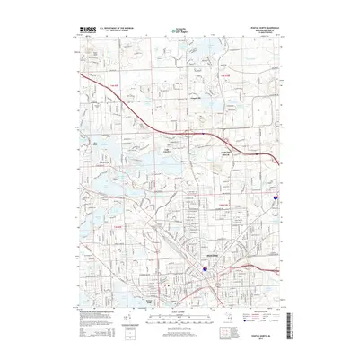
2014 Map of Pontiac North
USGS Topo · Published 2014About this map
Lake Angelus and the northern reaches of Pontiac anchor this 2014 survey of Oakland County, Michigan. The landscape is defined by its dense glacial lake system, from the sprawling waters of Lake Oakland and Loon Lake in the west to smaller basins like Judah Lake and Carpenter Lake in the east. Modern infrastructure like Dixie Hwy and the winding Brown Rd connects established neighborhoods and industrial centers. Significant historical and community markers are found throughout, including Sashabaw Cem, Oak Hill Cem, and the prominent Mt Hope Cem near the Dawsons Millpond. The topography varies from the lowlands of Galloway Creek to local high points like Pine Knob and Mt Judah, illustrating the complex terminal moraine geology that shaped this portion of the Detroit metropolitan periphery.
Find a feature on this map
68 named features on this map. Tap any name to fly to it.
Don’t see what you’re looking for? This feature index may not catch every label — zoom into the map to look around manually.
Map Details
Editions of this 2014 Pontiac North Map
This is the sole edition of this map. No revisions or reprints were ever made.
Other maps of this area

1907 · Pontiac
USGS Topo · 1:62,500

1908 · Rochester
USGS Topo · 1:62,500

1936 · Birmingham
USGS Topo · 1:31,680

1936 · Clarkston
USGS Topo · 1:31,680

1936 · Rochester
USGS Topo · 1:31,680

1936 · Walled Lake
USGS Topo · 1:31,680

1936 · Pontiac South
USGS Topo · 1:31,680

1936 · Pontiac North
USGS Topo · 1:31,680

1943 · Clarkston
USGS Topo · 1:24,000

1943 · Pontiac South
USGS Topo · 1:24,000
Featured Places
- Waterford Township, MI
- Pontiac, MI
- Orion Charter Township, MI
- Independence Charter Township, MI
- Auburn Hills, MI