
1957 Map of Poplar Bluff
USGS Topo · Published 1968About this map
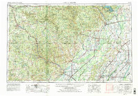
The Mark Twain National Forest dominates the rugged landscape of the eastern Ozarks in this late-1950s study. The terrain transitions from the steep, timbered ridges of the Current River Valley and Eleven Point River Valley to the flat alluvial plains of the Missouri Bootheel and Arkansas Delta. Significant conservation efforts are visible through the Eleven Point State Game Refuge and the Mingo National Wildlife Refuge, while the expansion of water management is anchored by Wappapello Lake on the St. Francis River.
Find a feature on this map
500 named features on this map. Tap any name to fly to it.
Don’t see what you’re looking for? This feature index may not catch every label — zoom into the map to look around manually.
Map Details
Editions of this 1957 Poplar Bluff Map
3 editions found
Other maps of this area

1890 · Batesville
USGS Topo · 1:125,000

1890 · Mountain Home
USGS Topo · 1:125,000

1891 · Mountain Home
USGS Topo · 1:125,000

1891 · Batesville
USGS Topo · 1:125,000

1892 · Mountain View
USGS Topo · 1:125,000

1894 · Mountain View
USGS Topo · 1:125,000

1894 · Mountain Home
USGS Topo · 1:125,000

1915 · Eminence
USGS Topo · 1:62,500

1917 · Eminence
USGS Topo · 1:62,500

1928 · Cardareva
USGS Topo · 1:62,500