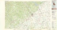
1983 Map of Poplar Bluff
USGS Topo · Published 1983About this map
The Black River and Current River define the hydraulic character of this Ozark foothills landscape, where the heavy timber of the Mark Twain National Forest meets the engineered drainage of the Missouri Bootheel. The transition from the rugged western ridges to the flat eastern plains is marked by an extensive network of canals, including Mingo Ditch and numerous numbered channels like Ditch No 1 and Ditch No 30. These efforts to reclaim the bottomlands for agriculture are punctuated by the massive Wappapello Lake and the preserved swamplands of the Mingo National Wildlife Refuge.
Find a feature on this map
158 named features on this map. Tap any name to fly to it.
Don’t see what you’re looking for? This feature index may not catch every label — zoom into the map to look around manually.
Map Details
Editions of this 1983 Poplar Bluff Map
This is the sole edition of this map. No revisions or reprints were ever made.
Other maps of this area

1928 · Cardareva
USGS Topo · 1:62,500

1932 · Piedmont
USGS Topo · 1:62,500

1934 · Greenville
USGS Topo · 1:62,500

1934 · Bloomfield
USGS Topo · 1:62,500

1934 · Advance
USGS Topo · 1:62,500

1934 · Williamsville
USGS Topo · 1:48,000

1934 · Puxico
USGS Topo · 1:62,500

1935 · Poplar Bluff
USGS Topo · 1:62,500

1935 · Zalma
USGS Topo · 1:62,500

1935 · Piedmont
USGS Topo · 1:62,500