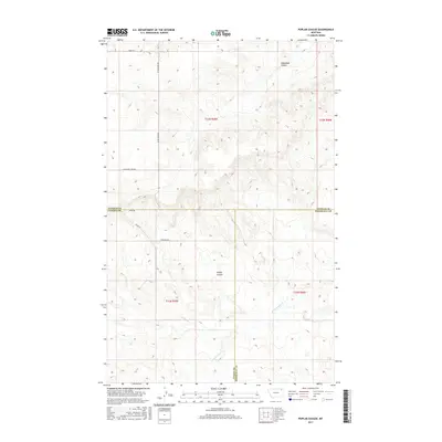
2017 Map of Poplar Coulee
USGS Topo · Published 2017About this map
Poplar Coulee and Shipstead Coulee carve through the high plains landscape of northeastern Montana in this 2017 survey. Situated where the borders of Daniels, Valley, and Roosevelt Counties meet, the terrain is defined by a systematic grid of section lines and rural thoroughfares such as Miner Rd and Winderal Rd. This map captures a specific moment in the rural development of the Wolf Point District, showing a landscape primarily shaped by natural drainage patterns like Cottonwood Cr and the functional requirements of large-scale prairie management.
Find a feature on this map
16 named features on this map. Tap any name to fly to it.
Don’t see what you’re looking for? This feature index may not catch every label — zoom into the map to look around manually.
Map Details
Editions of this 2017 Poplar Coulee Map
This is the sole edition of this map. No revisions or reprints were ever made.
Other maps of this area

1910 · Todd Lakes
USGS Topo · 1:62,500

1915 · Tule Valley
USGS Topo · 1:62,500

1915 · Todd Lakes
USGS Topo · 1:62,500

1954 · Wolf Point
USGS Topo · 1:250,000

1958 · Wolf Point
USGS Topo · 1:250,000

1973 · West Fork NE
USGS Topo · 1:24,000

1973 · Haugens Hill
USGS Topo · 1:24,000

1973 · Peerless 4 SW
USGS Topo · 1:24,000

1973 · Poplar Coulee
USGS Topo · 1:24,000
1973 · West Fork
USGS Topo · 1:24,000