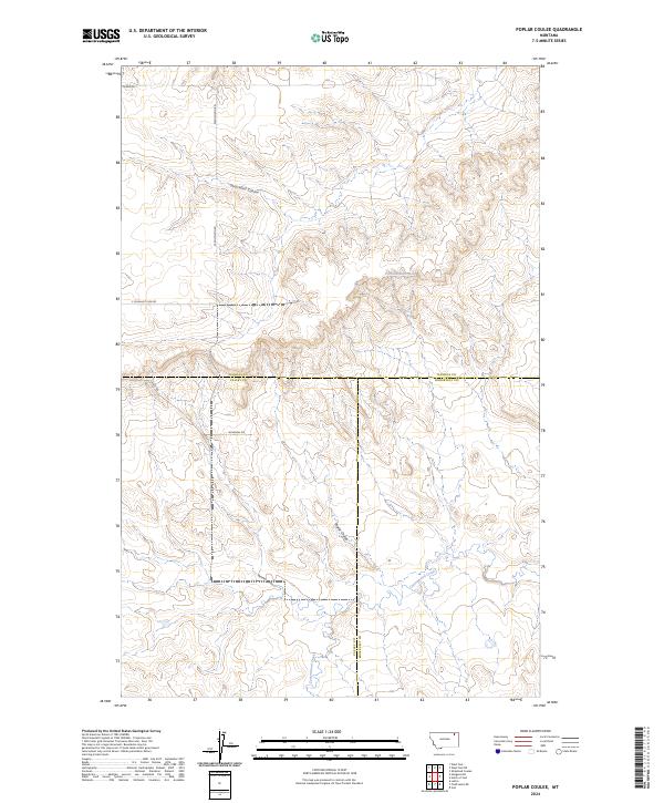
2024 Map of Poplar Coulee
USGS Topo · Published 2024About this map
Poplar Coulee and its surrounding high plains landscape define this remote corner of northeastern Montana, where three counties intersect across a network of seasonal drainages. This recent survey by the U.S. Geological Survey details the meeting point of Daniels, Valley, and Roosevelt counties, a region where the land is carved by the winding paths of Shipstead Coulee and Cottonwood Creek. The settlement pattern is sparse, consisting primarily of a geometric grid of rural routes such as Winderal Rd and W Wilcoxon Rd that serve the outlying ranching and farming tracts. The presence of the 33N45E26DBAD01 Spring highlights the vital importance of water sources in this dry prairie environment, while the absence of dense townsites emphasizes the vast, open character of the modern Montana frontier.
Find a feature on this map
16 named features on this map. Tap any name to fly to it.
Don’t see what you’re looking for? This feature index may not catch every label — zoom into the map to look around manually.
Map Details
Editions of this 2024 Poplar Coulee Map
This is the sole edition of this map. No revisions or reprints were ever made.
Other maps of this area

1910 · Todd Lakes
USGS Topo · 1:62,500

1915 · Tule Valley
USGS Topo · 1:62,500

1915 · Todd Lakes
USGS Topo · 1:62,500

1954 · Wolf Point
USGS Topo · 1:250,000

1958 · Wolf Point
USGS Topo · 1:250,000

1973 · West Fork NE
USGS Topo · 1:24,000

1973 · Haugens Hill
USGS Topo · 1:24,000

1973 · Peerless 4 SW
USGS Topo · 1:24,000

1973 · Poplar Coulee
USGS Topo · 1:24,000
1973 · West Fork
USGS Topo · 1:24,000