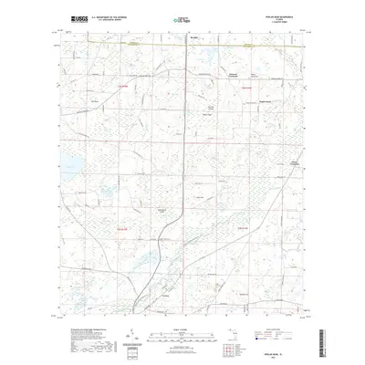
2021 Map of Poplar Head
USGS Topo · Published 2021About this map
Vernon and the surrounding pine-heavy lowlands of Washington Co and Holmes Co define this landscape along the meandering course of Holmes Creek. The terrain is characterized by a complex network of bays and ponds, such as Becton Pond, Pate Lake, and Bonnet Pond, which intersperse with distinctive elevated features like Poplar Head Hill and Chalk Hill. In the northern section, the settlement of Poplar Head sits near several named crossings, including Johnson Crossroad and Brock Crossroad, reflecting a rural road network heavily influenced by historical ferry routes like Douglas Ferry RD. The map reveals a land defined by water management and natural boundaries, from the wetlands of Lolly Head Bay to the curiosly named Little Devils Garden, illustrating the local vernacular for this unique section of the Florida Panhandle.
Find a feature on this map
108 named features on this map. Tap any name to fly to it.
Don’t see what you’re looking for? This feature index may not catch every label — zoom into the map to look around manually.
Map Details
Editions of this 2021 Poplar Head Map
This is the sole edition of this map. No revisions or reprints were ever made.
Other maps of this area

1949 · Millers Ferry
USGS Topo · 1:24,000

1949 · Hinsons Cross Roads
USGS Topo · 1:24,000

1949 · Caryville
USGS Topo · 1:24,000

1950 · Millers Ferry
USGS Topo · 1:24,000

1950 · Hinsons Cross Roads
USGS Topo · 1:24,000

1950 · Caryville
USGS Topo · 1:24,000

1950 · Vernon
USGS Topo · 1:24,000

1950 · Chipley
USGS Topo · 1:24,000

1950 · Wausau
USGS Topo · 1:24,000

1950 · Gap Lake
USGS Topo · 1:24,000