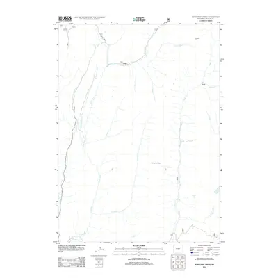
2012 Map of Porcupine Creek
USGS Topo · Published 2012About this map
The Oregon Trail Lander Cutoff defines the historical geography of this Lincoln County landscape, tracing a route across the northern portion of the quadrangle. This path, a vital branch of the emigrant trail, intersects with Smiths Fork Rd near the headwaters of numerous drainages. The area is characterized by a dense network of watercourses, including the various branches of the Smiths Fork, such as the Dry Fork Smiths Fork and W Fork Smiths Fork, which drain the high country around Porcupine Ridge. This 2012 survey illustrates a terrain of significant elevation change, from the basin of Crystal Lake to the prominent Buckskin Knoll in the northeast. The presence of named features like Bull Gulch and Trespass Cr reflects a naming tradition tied to early exploration and livestock movement in the Wyoming high desert and mountain transition zone.
Find a feature on this map
21 named features on this map. Tap any name to fly to it.
Don’t see what you’re looking for? This feature index may not catch every label — zoom into the map to look around manually.
Map Details
Editions of this 2012 Porcupine Creek Map
This is the sole edition of this map. No revisions or reprints were ever made.
Other maps of this area

1921 · Afton
USGS Topo · 1:125,000

1936 · Cokeville
USGS Topo · 1:96,000

1942 · Cokeville
USGS Topo · 1:125,000

1955 · Preston
USGS Topo · 1:250,000

1958 · Preston
USGS Topo · 1:250,000

1962 · Preston
USGS Topo · 1:250,000

1967 · Devils Hole Creek
USGS Topo · 1:24,000

1967 · Graham Peak
USGS Topo · 1:24,000

1967 · Big Park
USGS Topo · 1:24,000

1967 · Huff Lake
USGS Topo · 1:24,000