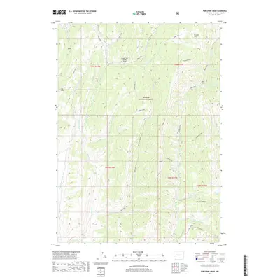
2017 Map of Porcupine Creek
USGS Topo · Published 2017About this map
The Lander Trail and the Oregon Trail Lander Cutoff bisect the northern half of this landscape, marking a historic corridor of westward migration through what is now the Bridger National Forest. This high-elevation terrain is defined by the drainage systems of Porcupine Creek and Hobble Creek, which flow through deep canyons and beneath prominent features like Buckskin Knoll and Porcupine Ridge. In the southeastern corner, a cluster of high-altitude water bodies including Lake Alice, Crystal Lake, and Spring Lake sit under the shadow of Lake Mountain. The presence of the Lake Alice Overlook and various forest roads like Smiths Fork Rd indicate the area's modern role for recreation and conservation, while the enduring paths of the historic emigrant trails provide a direct link to nineteenth-century transit history.
Find a feature on this map
42 named features on this map. Tap any name to fly to it.
Don’t see what you’re looking for? This feature index may not catch every label — zoom into the map to look around manually.
Map Details
Editions of this 2017 Porcupine Creek Map
This is the sole edition of this map. No revisions or reprints were ever made.
Other maps of this area

1921 · Afton
USGS Topo · 1:125,000

1936 · Cokeville
USGS Topo · 1:96,000

1942 · Cokeville
USGS Topo · 1:125,000

1955 · Preston
USGS Topo · 1:250,000

1958 · Preston
USGS Topo · 1:250,000

1962 · Preston
USGS Topo · 1:250,000

1967 · Devils Hole Creek
USGS Topo · 1:24,000

1967 · Graham Peak
USGS Topo · 1:24,000

1967 · Big Park
USGS Topo · 1:24,000

1967 · Huff Lake
USGS Topo · 1:24,000