
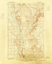
1918 Map of Porcupine Valley
USGS Topo · Published 1918About this map
Porcupine Valley defines this section of Valley County during the late 1910s, revealing a landscape of winding drainages and complex coulees. This 1918 edition, based on earlier surveys by the General Land Office and R.C. Seitz, documents the natural hydrology of the Missouri River watershed before modern water management altered the plains. The confluence of Porcupine Creek and its East Fork forms a central spine through the terrain, flanked by notable geological features like Enright Coulee and Sargent Creek. For researchers, the map provides a precise record of the public land survey system lines and early topography in a region defined by its seasonal watercourses, including Cherry Creek and Cherry Coulee, which shaped the early paths of travel and homesteading in the Montana high plains.
Find a feature on this map
9 named features on this map. Tap any name to fly to it.
Don’t see what you’re looking for? This feature index may not catch every label — zoom into the map to look around manually.
Map Details
Editions of this 1918 Porcupine Valley Map
2 editions found
Other maps of this area

1914 · Nashua
USGS Topo · 1:62,500

1915 · Frazer
USGS Topo · 1:62,500

1915 · Spring Creek
USGS Topo · 1:62,500

1916 · Nashua
USGS Topo · 1:62,500

1919 · Boundary
USGS Topo · 1:125,000

1943 · Glasgow
USGS Topo · 1:125,000

1954 · Glasgow
USGS Topo · 1:250,000

1957 · Glasgow
USGS Topo · 1:250,000

1958 · Glasgow
USGS Topo · 1:250,000

1958 · Whately
USGS Topo · 1:24,000