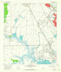
1962 Map of Port Acres
USGS Topo · Published 1964About this map
The Spindletop Oil Field and the Port Arthur industrial corridor define this coastal Texas landscape in the early 1960s. The map captures the dense concentration of petroleum infrastructure, from the Lovell Lake Oil Field to the sprawling networks of pipelines and oil tank farms that supported the regional economy. Residential expansion is visible in the neat grids of Port Acres and Beauxart Gardens, while older community anchors like Good Hope Chapel and the Little Flower Sch remain amidst the changing landscape. Hydrology plays a central role here, with the Port Arthur Fresh Water Canal cutting across the terrain toward the Big Hill Reservoir. The transition from the salt marshes of Hillebrandt Bayou to the bustling rail lines of the Southern Pacific illustrates the mid-century intersection of natural wetlands and heavy industry.
Find a feature on this map
45 named features on this map. Tap any name to fly to it.
Don’t see what you’re looking for? This feature index may not catch every label — zoom into the map to look around manually.
Map Details
Editions of this 1962 Port Acres Map
4 editions found
Other maps of this area

1926 · Terry
USGS Topo · 1:24,000

1926 · Vidor
USGS Topo · 1:24,000

1932 · Beaumont
USGS Topo · 1:62,500

1943 · Port Arthur North
USGS Topo · 1:24,000

1943 · Terry
USGS Topo · 1:24,000

1943 · Port Arthur South
USGS Topo · 1:24,000

1943 · Fannett East
USGS Topo · 1:24,000

1943 · Beaumont East
USGS Topo · 1:24,000

1945 · Fannett East
USGS Topo · 1:31,680

1950 · Houston
USGS Topo · 1:250,000