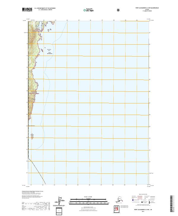
2021 Map of Port Alexander A-2 NW
USGS Topo · Published 2021About this map
Port Alexander sits on the southern tip of Baranof Island, serving as a vital outpost where the coastal forest meets the open Pacific. This 2021 survey illustrates the settlement's relationship with its sheltered harbor, positioned just north of the dramatic headland at Cape Ommaney. The landscape is dominated by the dense timber of the Tongass National Forest, which covers the narrow strip of land between the sea and the boundary of the Sitka borough. Offshore, maritime hazards and landmarks such as Breakfast Rock and Wooden Island define the approach to the port. The map provides a clear view of the cadastral grid, including township markers like t65s r69e, reflecting how this remote Alaskan terrain is organized within the larger Prince of Wales-Hyder Census Area.
Find a feature on this map
12 named features on this map. Tap any name to fly to it.
Don’t see what you’re looking for? This feature index may not catch every label — zoom into the map to look around manually.
Map Details
Editions of this 2021 Port Alexander A-2 NW Map
This is the sole edition of this map. No revisions or reprints were ever made.
Other maps of this area

1948 · Port Alexander A-2
USGS Topo · 1:63,360
1948 · Port Alexander A-3
USGS Topo · 1:63,360

1948 · Port Alexander B-2
USGS Topo · 1:63,360

1951 · Port Alexander B-3 and B-4
USGS Topo · 1:63,360

1951 · Port Alexander
USGS Topo · 1:250,000

1951 · Port Alexander B-2
USGS Topo · 1:63,360
1951 · Port Alexander A-3
USGS Topo · 1:63,360
1951 · Port Alexander A-2
USGS Topo · 1:63,360

1952 · Port Alexander
USGS Topo · 1:250,000

1964 · Port Alexander
USGS Topo · 1:250,000