
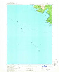
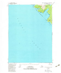
1951 Map of Port Alexander A-3
USGS Topo · Published 1986About this map
Baranof Island terminates at the southern tip of the City and Borough of Sitka in this mid-century topographical record. This coastline is defined by protected harbors like Port Conclusion and Puffin Bay, which provided essential shelter for maritime navigation along the exposed Pacific Ocean front. The landscape is dominated by the wilderness of the Tongass National Forest, rising sharply from the sea to elevations like Ommaney Peak.
Find a feature on this map
18 named features on this map. Tap any name to fly to it.
Don’t see what you’re looking for? This feature index may not catch every label — zoom into the map to look around manually.
Map Details
Editions of this 1951 Port Alexander A-3 Map
3 editions found
Historical Maps of Sitka Through Time
247 maps found

1948 Port Alexander A-2
Sitka Borough, AK

1948 Port Alexander A-3
Sitka Borough, AK

1948 Port Alexander B-2
Sitka Borough, AK

1948 Sitka A-3
Sitka Borough, AK

1948 Sitka A-5
Sitka Borough, AK

1948 Sitka B-3
Sitka Borough, AK

1948 Sitka B-5
Sitka Borough, AK

1948 Sitka C-3
Sitka Borough, AK

1948 Sitka C-6
Sitka Borough, AK

1948 Sitka C-7
Sitka Borough, AK

1948 Sitka D-6
Sitka Borough, AK

1951 Port Alexander A-2
Sitka Borough, AK
1951 Port Alexander A-3
Sitka Borough, AK

1951 Port Alexander B-2
Sitka Borough, AK

1951 Port Alexander B-3 and B-4
Sitka Borough, AK

1951 Port Alexander C-2
Sitka Borough, AK

1951 Port Alexander C-3
Sitka Borough, AK

1951 Port Alexander C-4
Sitka Borough, AK

1951 Port Alexander D-3
Sitka Borough, AK

1951 Port Alexander D-4
Sitka Borough, AK

1951 Port Alexander D-5
Sitka Borough, AK

1951 Port Alexander
Sitka Borough, AK

1951 Sitka A-3
Sitka Borough, AK

1951 Sitka A-4
Sitka Borough, AK

1951 Sitka A-5
Sitka Borough, AK

1951 Sitka A-6
Sitka Borough, AK

1951 Sitka B-3
Sitka Borough, AK

1951 Sitka B-4
Sitka Borough, AK

1951 Sitka B-5
Sitka Borough, AK

1951 Sitka B-6
Sitka Borough, AK

1951 Sitka C-3
Sitka Borough, AK

1951 Sitka C-4
Sitka Borough, AK

1951 Sitka C-5
Sitka Borough, AK

1951 Sitka C-6
Sitka Borough, AK

1951 Sitka C-7
Sitka Borough, AK

1951 Sitka D-6
Sitka Borough, AK

1952 Port Alexander
Sitka Borough, AK

1954 Sitka A-4
Sitka Borough, AK

1964 Port Alexander
Sitka Borough, AK

1987 Sitka A-4 SW
Sitka Borough, AK

1987 Sitka A-5 SE
Sitka Borough, AK

1994 Port Alexander C-3
Sitka Borough, AK

1994 Port Alexander C-4
Sitka Borough, AK

1994 Sitka C-7
Sitka Borough, AK

1995 Port Alexander D-3
Sitka Borough, AK

1996 Sitka A-3
Sitka Borough, AK

1996 Sitka A-5
Sitka Borough, AK

1996 Sitka B-5
Sitka Borough, AK

1996 Sitka B-6
Sitka Borough, AK

1997 Sitka B-3
Sitka Borough, AK

1997 Sitka C-3
Sitka Borough, AK

2000 Sitka D-6
Sitka Borough, AK

2017 Port Alexander A-2 NW
Sitka Borough, AK

2017 Port Alexander A-3 NE
Sitka Borough, AK

2017 Port Alexander B-2 NW
Sitka Borough, AK

2017 Port Alexander B-2 SW
Sitka Borough, AK

2017 Port Alexander B-3 NE
Sitka Borough, AK

2017 Port Alexander B-3 NW
Sitka Borough, AK

2017 Port Alexander B-3 SE
Sitka Borough, AK

2017 Port Alexander B-3 SW
Sitka Borough, AK

2017 Port Alexander B-4 NE
Sitka Borough, AK

2017 Port Alexander C-2 NE
Sitka Borough, AK

2017 Port Alexander C-2 NW
Sitka Borough, AK

2017 Port Alexander C-2 SW
Sitka Borough, AK

2017 Port Alexander C-3 NE
Sitka Borough, AK

2017 Port Alexander C-3 NW
Sitka Borough, AK

2017 Port Alexander C-3 SE
Sitka Borough, AK

2017 Port Alexander C-3 SW
Sitka Borough, AK

2017 Port Alexander C-4 NE
Sitka Borough, AK

2017 Port Alexander C-4 NW
Sitka Borough, AK

2017 Port Alexander C-4 SE
Sitka Borough, AK

2017 Port Alexander D-2 SW
Sitka Borough, AK

2017 Port Alexander D-3 NE
Sitka Borough, AK

2017 Port Alexander D-3 NW
Sitka Borough, AK

2017 Port Alexander D-3 SE
Sitka Borough, AK

2017 Port Alexander D-3 SW
Sitka Borough, AK

2017 Port Alexander D-4 NE
Sitka Borough, AK

2017 Port Alexander D-4 NW
Sitka Borough, AK

2017 Port Alexander D-4 SE
Sitka Borough, AK

2017 Port Alexander D-4 SW
Sitka Borough, AK

2017 Port Alexander D-5 NE
Sitka Borough, AK

2017 Port Alexander D-5 NW
Sitka Borough, AK

2017 Port Alexander D-5 SE
Sitka Borough, AK

2017 Port Alexander D-5 SW
Sitka Borough, AK

2017 Sitka A-3 NE
Sitka Borough, AK

2017 Sitka A-3 NW
Sitka Borough, AK

2017 Sitka A-3 SE
Sitka Borough, AK

2017 Sitka A-3 SW
Sitka Borough, AK

2017 Sitka A-4 NE
Sitka Borough, AK

2017 Sitka A-4 NW
Sitka Borough, AK

2017 Sitka A-4 SE
Sitka Borough, AK

2017 Sitka A-4 SW
Sitka Borough, AK

2017 Sitka A-5 NE
Sitka Borough, AK

2017 Sitka A-5 NW
Sitka Borough, AK

2017 Sitka A-5 SE
Sitka Borough, AK

2017 Sitka A-5 SW
Sitka Borough, AK

2017 Sitka A-6 NE
Sitka Borough, AK

2017 Sitka A-6 NW
Sitka Borough, AK

2017 Sitka A-6 OE S NE
Sitka Borough, AK

2017 Sitka A-6 OE S NW
Sitka Borough, AK

2017 Sitka A-6 SE
Sitka Borough, AK

2017 Sitka A-6 SW
Sitka Borough, AK

2017 Sitka B-3 NE
Sitka Borough, AK

2017 Sitka B-3 NW
Sitka Borough, AK

2017 Sitka B-3 SE
Sitka Borough, AK

2017 Sitka B-3 SW
Sitka Borough, AK

2017 Sitka B-4 NE
Sitka Borough, AK

2017 Sitka B-4 NW
Sitka Borough, AK

2017 Sitka B-4 SE
Sitka Borough, AK

2017 Sitka B-4 SW
Sitka Borough, AK

2017 Sitka B-5 NE
Sitka Borough, AK

2017 Sitka B-5 NW
Sitka Borough, AK

2017 Sitka B-5 SE
Sitka Borough, AK

2017 Sitka B-5 SW
Sitka Borough, AK

2017 Sitka B-6 NE
Sitka Borough, AK

2017 Sitka B-6 NW
Sitka Borough, AK

2017 Sitka B-6 SE
Sitka Borough, AK

2017 Sitka B-6 SW
Sitka Borough, AK

2017 Sitka C-3 NE
Sitka Borough, AK

2017 Sitka C-3 NW
Sitka Borough, AK

2017 Sitka C-3 SE
Sitka Borough, AK

2017 Sitka C-3 SW
Sitka Borough, AK

2017 Sitka C-4 NE
Sitka Borough, AK

2017 Sitka C-4 NW
Sitka Borough, AK

2017 Sitka C-4 SE
Sitka Borough, AK

2017 Sitka C-4 SW
Sitka Borough, AK

2017 Sitka C-5 NE
Sitka Borough, AK

2017 Sitka C-5 NW
Sitka Borough, AK

2017 Sitka C-5 SE
Sitka Borough, AK

2017 Sitka C-5 SW
Sitka Borough, AK

2017 Sitka C-6 NE
Sitka Borough, AK

2017 Sitka C-6 NW
Sitka Borough, AK

2017 Sitka C-6 SE
Sitka Borough, AK

2017 Sitka C-6 SW
Sitka Borough, AK

2017 Sitka C-7 NE
Sitka Borough, AK

2017 Sitka C-7 NW
Sitka Borough, AK

2017 Sitka C-7 OE S NE
Sitka Borough, AK

2017 Sitka C-7 SE
Sitka Borough, AK

2017 Sitka D-5 SE
Sitka Borough, AK

2017 Sitka D-5 SW
Sitka Borough, AK

2017 Sitka D-6 NE
Sitka Borough, AK

2017 Sitka D-6 NW
Sitka Borough, AK

2017 Sitka D-6 SE
Sitka Borough, AK

2017 Sitka D-6 SW
Sitka Borough, AK

2017 Sitka D-7 SE
Sitka Borough, AK

2017 Sitka D-7 SW
Sitka Borough, AK

2017 Sitka D-8 SE
Sitka Borough, AK

2018 Port Alexander C-4 OE W NE
Sitka Borough, AK

2018 Port Alexander C-4 SW
Sitka Borough, AK

2021 Port Alexander A-2 NW
Sitka Borough, AK

2021 Port Alexander A-3 NE
Sitka Borough, AK

2021 Port Alexander B-2 NW
Sitka Borough, AK

2021 Port Alexander B-2 SW
Sitka Borough, AK

2021 Port Alexander B-3 NE
Sitka Borough, AK

2021 Port Alexander B-3 NW
Sitka Borough, AK

2021 Port Alexander B-3 SE
Sitka Borough, AK

2021 Port Alexander B-3 SW
Sitka Borough, AK

2021 Port Alexander B-4 NE
Sitka Borough, AK

2021 Port Alexander C-2 NE
Sitka Borough, AK

2021 Port Alexander C-2 NW
Sitka Borough, AK

2021 Port Alexander C-2 SW
Sitka Borough, AK

2021 Port Alexander C-3 NE
Sitka Borough, AK

2021 Port Alexander C-3 NW
Sitka Borough, AK

2021 Port Alexander C-3 SE
Sitka Borough, AK

2021 Port Alexander C-3 SW
Sitka Borough, AK

2021 Port Alexander C-4 NE
Sitka Borough, AK

2021 Port Alexander C-4 NW
Sitka Borough, AK

2021 Port Alexander C-4 OE W NE
Sitka Borough, AK

2021 Port Alexander C-4 SE
Sitka Borough, AK

2021 Port Alexander D-2 SW
Sitka Borough, AK

2021 Port Alexander D-3 NE
Sitka Borough, AK

2021 Port Alexander D-3 NW
Sitka Borough, AK

2021 Port Alexander D-3 SE
Sitka Borough, AK

2021 Port Alexander D-3 SW
Sitka Borough, AK

2021 Port Alexander D-4 NE
Sitka Borough, AK

2021 Port Alexander D-4 NW
Sitka Borough, AK

2021 Port Alexander D-4 SE
Sitka Borough, AK

2021 Port Alexander D-4 SW
Sitka Borough, AK

2021 Port Alexander D-5 NE
Sitka Borough, AK

2021 Port Alexander D-5 NW
Sitka Borough, AK

2021 Port Alexander D-5 SE
Sitka Borough, AK

2021 Port Alexander D-5 SW
Sitka Borough, AK

2021 Sitka A-3 NE
Sitka Borough, AK

2021 Sitka A-3 NW
Sitka Borough, AK

2021 Sitka A-3 SE
Sitka Borough, AK

2021 Sitka A-3 SW
Sitka Borough, AK

2021 Sitka A-4 NE
Sitka Borough, AK

2021 Sitka A-4 NW
Sitka Borough, AK

2021 Sitka A-4 SE
Sitka Borough, AK

2021 Sitka A-4 SW
Sitka Borough, AK

2021 Sitka A-5 NE
Sitka Borough, AK

2021 Sitka A-5 NW
Sitka Borough, AK

2021 Sitka A-5 SE
Sitka Borough, AK

2021 Sitka A-5 SW
Sitka Borough, AK

2021 Sitka A-6 NE
Sitka Borough, AK

2021 Sitka A-6 NW
Sitka Borough, AK

2021 Sitka A-6 OE S NE
Sitka Borough, AK

2021 Sitka A-6 OE S NW
Sitka Borough, AK

2021 Sitka A-6 SE
Sitka Borough, AK

2021 Sitka A-6 SW
Sitka Borough, AK

2021 Sitka B-3 NE
Sitka Borough, AK

2021 Sitka B-3 NW
Sitka Borough, AK

2021 Sitka B-3 SE
Sitka Borough, AK

2021 Sitka B-3 SW
Sitka Borough, AK

2021 Sitka B-4 NE
Sitka Borough, AK

2021 Sitka B-4 NW
Sitka Borough, AK

2021 Sitka B-4 SE
Sitka Borough, AK

2021 Sitka B-4 SW
Sitka Borough, AK

2021 Sitka B-5 NE
Sitka Borough, AK

2021 Sitka B-5 NW
Sitka Borough, AK

2021 Sitka B-5 SE
Sitka Borough, AK

2021 Sitka B-5 SW
Sitka Borough, AK

2021 Sitka B-6 NE
Sitka Borough, AK

2021 Sitka B-6 NW
Sitka Borough, AK

2021 Sitka B-6 SE
Sitka Borough, AK

2021 Sitka B-6 SW
Sitka Borough, AK

2021 Sitka C-3 NE
Sitka Borough, AK

2021 Sitka C-3 NW
Sitka Borough, AK

2021 Sitka C-3 SE
Sitka Borough, AK

2021 Sitka C-3 SW
Sitka Borough, AK

2021 Sitka C-4 NE
Sitka Borough, AK

2021 Sitka C-4 NW
Sitka Borough, AK

2021 Sitka C-4 SE
Sitka Borough, AK

2021 Sitka C-4 SW
Sitka Borough, AK

2021 Sitka C-5 NE
Sitka Borough, AK

2021 Sitka C-5 NW
Sitka Borough, AK

2021 Sitka C-5 SE
Sitka Borough, AK

2021 Sitka C-5 SW
Sitka Borough, AK

2021 Sitka C-6 NE
Sitka Borough, AK

2021 Sitka C-6 NW
Sitka Borough, AK

2021 Sitka C-6 SE
Sitka Borough, AK

2021 Sitka C-6 SW
Sitka Borough, AK

2021 Sitka C-7 NE
Sitka Borough, AK

2021 Sitka C-7 NW
Sitka Borough, AK

2021 Sitka C-7 OE S NE
Sitka Borough, AK

2021 Sitka C-7 SE
Sitka Borough, AK

2021 Sitka D-5 SE
Sitka Borough, AK

2021 Sitka D-5 SW
Sitka Borough, AK

2021 Sitka D-6 NE
Sitka Borough, AK

2021 Sitka D-6 NW
Sitka Borough, AK

2021 Sitka D-6 SE
Sitka Borough, AK

2021 Sitka D-6 SW
Sitka Borough, AK

2021 Sitka D-7 SE
Sitka Borough, AK

2021 Sitka D-7 SW
Sitka Borough, AK

2021 Sitka D-8 SE
Sitka Borough, AK

2024 Sitka C-3 NE
Sitka Borough, AK

2024 Sitka C-3 SE
Sitka Borough, AK