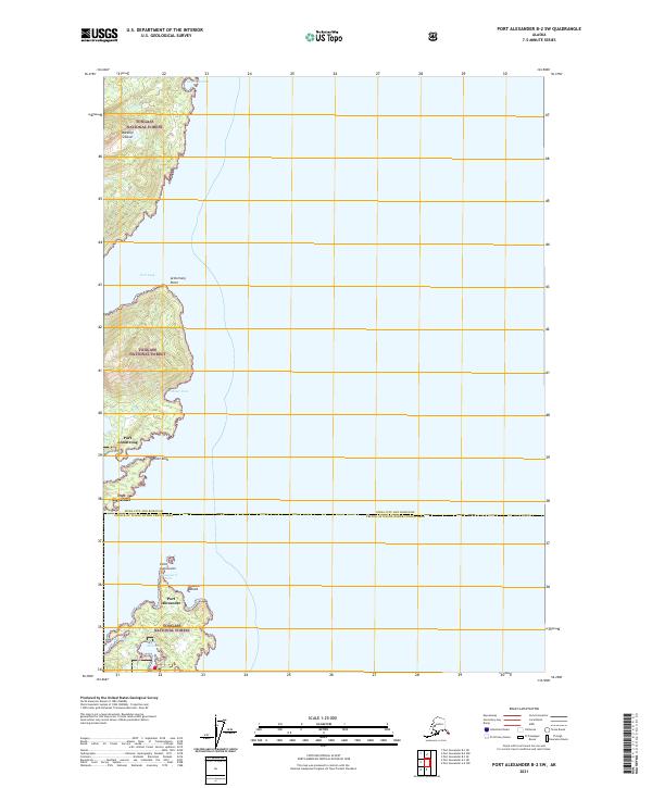
2021 Map of Port Alexander B-2 SW
USGS Topo · Published 2021About this map
Baranof Island serves as the backdrop for this coastal study within the Tongass National Forest. The map details the intricate shoreline where the Pacific meets the southeastern edge of the island, highlighting small settlements like Port Alexander and Port Armstrong that define the region's human geography. These outposts are joined by a series of maritime landmarks, including Point Conclusion and Point Eliza, which have long served as navigational aids for those traversing the local waters. The interplay between the shoreline and the interior is marked by numerous indentations such as Port Lucy and Miner Cove. This 2021 survey also documents the administrative boundary between the Sitka City and Borough and the Prince of Wales-Hyder Census Area, showing how modern jurisdictional lines intersect with the complex geography of the Alexander Archipelago.
Find a feature on this map
19 named features on this map. Tap any name to fly to it.
Don’t see what you’re looking for? This feature index may not catch every label — zoom into the map to look around manually.
Map Details
Editions of this 2021 Port Alexander B-2 SW Map
This is the sole edition of this map. No revisions or reprints were ever made.
Other maps of this area

1948 · Port Alexander A-2
USGS Topo · 1:63,360
1948 · Port Alexander A-3
USGS Topo · 1:63,360

1948 · Port Alexander B-2
USGS Topo · 1:63,360

1951 · Port Alexander B-3 and B-4
USGS Topo · 1:63,360

1951 · Port Alexander
USGS Topo · 1:250,000

1951 · Port Alexander B-2
USGS Topo · 1:63,360
1951 · Port Alexander A-3
USGS Topo · 1:63,360
1951 · Port Alexander A-2
USGS Topo · 1:63,360

1952 · Port Alexander
USGS Topo · 1:250,000

1964 · Port Alexander
USGS Topo · 1:250,000