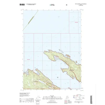
2017 Map of Port Alexander D-1 NW
USGS Topo · Published 2017About this map
Frederick Sound dominates the northern reaches of this coastal survey, where the maritime boundaries of the Tongass National Forest meet the complex shoreline of Kuiu Island. The land is defined by prominent coastal markers such as Cornwallis Point and the steep elevation of Fossil Bluffs, which overlook the protected waters of Halleck Harbor. To the south, the deep indentation of Saginaw Bay creates a convoluted coastline scattered with smaller islands and inland water bodies. Small, isolated lakes including Ledge Lake and Cool Lake sit tucked within the timbered interior, while Sachem Island stands as a distinct landmark within the bay. This map captures the intricate geography of the Alexander Archipelago at a time when digital elevation datasets and modern hydrography provided a precise record of this coastal wilderness.
Find a feature on this map
10 named features on this map. Tap any name to fly to it.
Don’t see what you’re looking for? This feature index may not catch every label — zoom into the map to look around manually.
Map Details
Editions of this 2017 Port Alexander D-1 NW Map
This is the sole edition of this map. No revisions or reprints were ever made.
Other maps of this area

1948 · Sitka A-2
USGS Topo · 1:63,360

1948 · Port Alexander D-1
USGS Topo · 1:63,360

1948 · Sitka A-1
USGS Topo · 1:63,360

1951 · Sitka
USGS Topo · 1:250,000

1951 · Port Alexander
USGS Topo · 1:250,000

1951 · Port Alexander D-2
USGS Topo · 1:63,360

1951 · Sitka A-2
USGS Topo · 1:63,360

1952 · Port Alexander
USGS Topo · 1:250,000

1952 · Sitka
USGS Topo · 1:250,000

1964 · Sitka
USGS Topo · 1:250,000