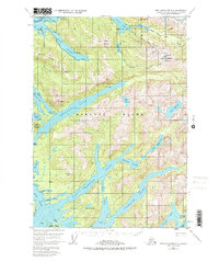
1951 Map of Port Alexander D-4
USGS Topo · Published 1978About this map
Baranof Island provides a complex coastal landscape of deep fjords and high peaks in this mid-century topographic record. The map details the intricate waterways of West Crawfish Inlet and Crawfish Inlet, which carve into the island's interior near Lodge Island and the Rakof Islands. For those interested in industrial history, a Mine is located near the Lucky Chance Lakes on Lucky Chance Mountain, suggesting early extraction efforts in these isolated mountains.
Find a feature on this map
42 named features on this map. Tap any name to fly to it.
Don’t see what you’re looking for? This feature index may not catch every label — zoom into the map to look around manually.
Map Details
Editions of this 1951 Port Alexander D-4 Map
4 editions found
Other maps of this area

1948 · Sitka A-5
USGS Topo · 1:63,360

1948 · Sitka A-3
USGS Topo · 1:63,360

1951 · Port Alexander D-5
USGS Topo · 1:63,360

1951 · Sitka
USGS Topo · 1:250,000

1951 · Port Alexander C-4
USGS Topo · 1:63,360

1951 · Port Alexander D-4
USGS Topo · 1:63,360

1951 · Port Alexander C-3
USGS Topo · 1:63,360

1951 · Port Alexander D-3
USGS Topo · 1:63,360

1951 · Port Alexander
USGS Topo · 1:250,000

1951 · Sitka A-4
USGS Topo · 1:63,360