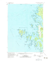
1951 Map of Port Alexander D-5
USGS Topo · Published 1983About this map
Biorka Island stands at the western edge of this coastal survey, serving as a prominent landmark for those navigating Sitka Sound toward the Pacific Ocean. This 1951 record captures the intricate shoreline of the Taigud Islands and the western fringe of Baranof Island before modern development. At Goddard, situated near Hot Springs Bay and Kliuchef Bay, the map notes a concentration of activity including a radio tower and observation post.
Find a feature on this map
80 named features on this map. Tap any name to fly to it.
Don’t see what you’re looking for? This feature index may not catch every label — zoom into the map to look around manually.
Map Details
Editions of this 1951 Port Alexander D-5 Map
Other maps of this area

1948 · Sitka A-5
USGS Topo · 1:63,360

1951 · Sitka A-6
USGS Topo · 1:63,360

1951 · Port Alexander D-5
USGS Topo · 1:63,360

1951 · Sitka
USGS Topo · 1:250,000

1951 · Port Alexander C-4
USGS Topo · 1:63,360

1951 · Port Alexander D-4
USGS Topo · 1:63,360

1951 · Port Alexander
USGS Topo · 1:250,000

1951 · Sitka A-4
USGS Topo · 1:63,360

1951 · Sitka A-5
USGS Topo · 1:63,360

1952 · Port Alexander
USGS Topo · 1:250,000