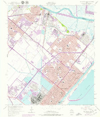
1957 Map of Port Arthur North
USGS Topo · Published 1979About this map
Industrial expansion and suburban growth define the Texas Gulf Coast as it transitioned through the mid-20th century. Along the Neches River, massive Refinery and Tank Farm complexes dominate the shoreline near Smith Bluff, illustrating the era's petroleum-driven economy. Inland, the map reveals the dense residential patterns of Port Arthur, Groves, and Port Neches, punctuated by numerous civic institutions like Port Arthur College and St Marys Hospital.
Find a feature on this map
59 named features on this map. Tap any name to fly to it.
Don’t see what you’re looking for? This feature index may not catch every label — zoom into the map to look around manually.
Map Details
Editions of this 1957 Port Arthur North Map
4 editions found
Other maps of this area

1926 · Terry
USGS Topo · 1:24,000

1926 · Vidor
USGS Topo · 1:24,000

1932 · Beaumont
USGS Topo · 1:62,500

1932 · Port Arthur NE
USGS Topo · 1:31,680

1943 · West of Johnson Bayou
USGS Topo · 1:24,000

1943 · West of Greens Bayou
USGS Topo · 1:24,000

1943 · Orangefield
USGS Topo · 1:24,000

1943 · Port Arthur North
USGS Topo · 1:24,000

1943 · Terry
USGS Topo · 1:24,000

1943 · Port Arthur South
USGS Topo · 1:24,000